
Country China County Wenchuan Time zone China Standard (UTC+8) Population 6,906 (2007) | Province Sichuan Elevation 1,012 m (3,320 ft) Postal code 513221102 Local time Sunday 12:03 PM | |
 | ||
Weather 16°C, Wind S at 6 km/h, 83% Humidity | ||
Wenchuan 8 years on new highway to connect yingxiu wolong
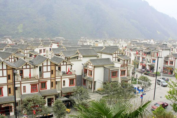
Yingxiu (Chinese: 映秀; pinyin: Yìngxiù) is a town of southern Wenchuan County, northwestern Sichuan province of Southwest China. It is located at the southern end of the Ngawa Tibetan and Qiang Autonomous Prefecture, and lies on the road to Jiuzhaigou Valley, Wolong and the Siguniang Mountains. It is located 47 kilometres (29 mi) south of the county urban centre, and just 14 kilometres (8.7 mi) west of the city of Dujiangyan. The town has an area of 115 square kilometres (44 sq mi), and as of 2007, a population of 6,906.
Contents
- Wenchuan 8 years on new highway to connect yingxiu wolong
- Map of Yingxiuzhen Wenchuan Aba Sichuan China
- Euronews no comment china yingxiu
- References
Map of Yingxiuzhen, Wenchuan, Aba, Sichuan, China
It is at the epicentre and one of the worst hit areas of the 2008 Sichuan earthquake. 80% of the town was destroyed. The town was the first journalists were able to reach inside Wenchuan County. Benevolence Square, built by the Chinese government at the epicentre of the earthquake, contains a huge boulder lying below the surface and surrounded by a moat. A plaque, in Chinese and English, reads as follows: Benevolence Square: It was arable land before the earthquake. A boulder flew down here during the earthquake, people engraved it with the words 5.12 Epicenter Yingxiu.