
 | ||
Similar Jiufen, Queen's Head, Yehliu Geopark, Shifen Waterfall, Jinguashi | ||
Taiwan day 2 jiufen pingxi yehliu geopark
Yehliu (Chinese: 野柳; pinyin: Yěliǔ) is a cape in Wanli District, New Taipei, Taiwan.
Contents
- Taiwan day 2 jiufen pingxi yehliu geopark
- Map of Yeliou New Taipei City Taiwan
- Taiwan yehliu geopark trip photo album
- References
Map of Yeliou, New Taipei City, Taiwan
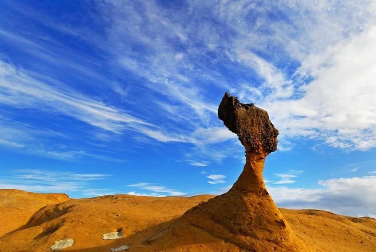
The cape, known by geologists as the Yehliu Promontory, forms part of the Daliao Miocene Formation. It stretches approximately 1,700 metres into the ocean and was formed as geological forces pushed the Datun Mountains out of the sea.
A distinctive feature of the cape is the hoodoo stones that dot its surface. These shapes can be viewed at the Yehliu Geopark operated by the North Coast and Guanyinshan National Scenic Area administration. A number of rock formations have been given imaginative names based on their shapes. The best known is the "Queen's Head" (女王頭), an iconic image in Taiwan and an unofficial emblem for the town of Wanli. Other formations include the "Fairy Shoe", the "Beehive", the "Ginger Rocks", and the "Sea Candles".