 | ||
Municipal district Providensky Municipal District Rural settlement Yanrakynnot Rural Settlement Administrative center of Yanrakynnot Rural Settlement | ||
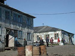
Yanrakynnot (Russian: Янракыннот) is a rural locality (a selo) in Providensky District of Chukotka Autonomous Okrug, Russia. Population: 338 (2010 Census); Municipally, Yanrakynnot is a part of Yanrakynnot Rural Settlement in Providensky Municipal District.
Contents
Map of Yanrakynnot, Russia, 689271
Etymology
Its name is derived from the Chukchi word for "detached, firm land", although other sources translate it as "the lonely stand", and others still say it means "hard place".
History
Like many of the small rural localities in Chukotka, the amenities of Yanrakynnot were affected by the dissolution of the Soviet Union; the eight-grade school, for example, was downgraded to just a four-grade school.
Geography
Yanrakynnot is located on the shores of the Venetken (lit. "curved") lagoon, linked to the administrative center of the district, the urban-type settlement of Provideniya, by an 80-kilometer (50 mi) unpaved road.
Demographics
The population according to the most recent census data is 338, of whom 185 were male and 153 female, a slight increase on a 2008 estimate of 330.
Economy
Yanrakynnot is a traditional Chukchi locality, with the economy being dominated by whaling. The locality also serves as a base for those wishing to visit Whale Bone Alley on Yttygran Island or Arakamchechen Island.
Climate
Yanrakynnot has a Tundra climate (ET) because the warmest month has an average temperature between 0 °C (32 °F) and 10 °C (50 °F).
