
District Ōshima Area 88.15 km² Local time Monday 11:03 AM | Population 1,638 (1 Jun 2013) | |
 | ||
Weather 21°C, Wind S at 29 km/h, 95% Humidity | ||
Yamato (大和村, Yamato-son) is a village located on Amami Ōshima, in Ōshima District, Kagoshima Prefecture, Japan.
Contents
- Map of Yamato Oshima District Kagoshima Prefecture Japan
- Geography
- Surrounding municipalities
- History
- Economy
- References
Map of Yamato, Oshima District, Kagoshima Prefecture, Japan
As of June 2013, the village had an estimated population of 1,638 and a population density of 18.6 persons per km². The total area was 88.15 km².
Geography
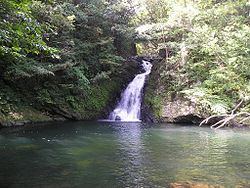
Yamato occupies the central portion of the northeast coast of Amami Ōshima, facing the East China Sea. The climate is classified as humid subtropical (Köppen climate classification Cfa) with very warm summers and mild winters. Precipitation is high throughout the year, but is highest in the months of May, June and September. The area is subject to frequent typhoons.
Surrounding municipalities
History
Yamato Village was established on April 1, 1908. As with all of the Amami Islands, the village came under the administration of the United States from July 1, 1946 to December 25, 1953.
Economy
The village economy is primarily agricultural, with sugar cane and horticulture as the main activities.