
- Flower Rosa rugosa Population 16,055 (Feb 2014) | - Tree Cryptomeria Area 263.4 km² | |
 | ||
Weather 10°C, Wind W at 14 km/h, 48% Humidity | ||
Yamada (山田町, Yamada-machi) is a town in Shimohei District, Iwate Prefecture, Japan. As of February 2014, the town had an estimated population of 16,055 and a population density of 60.09 persons per km2. The total area was 263.45 km2.
Contents
- Map of Yamada Shimohei District Iwate Prefecture Japan
- Geography
- Neighboring municipalities
- History
- Economy
- Rail
- Highways
- Sister city relations
- Notable people from Yamada
- References
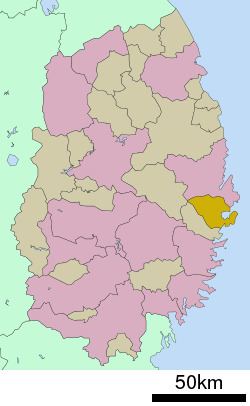
Map of Yamada, Shimohei District, Iwate Prefecture, Japan
Geography
Yamada is located on the ria coastline of central Iwate Prefecture, facing the Pacific Ocean
Neighboring municipalities
History
The area of present-day Yamada was part of ancient Mutsu Province, dominated by the Nambu clan during the Edo period, who ruled Morioka Domain under the Tokugawa shogunate. The town of Yamada was created within Higashihei District on April 1, 1889. Kitahei, Nakahei and Higashihei Districts were all merged into Minamihei District on March 29, 1896. On March 1, 1955, Yamada annexed the neighboring villages of Funakoshi, Orikada, Osawa and Toyomane to reach is present borders. After the March 2011 earthquake, it was reported that the town had been almost completely submerged by the ensuing tsunami.
Economy
The local economy was strongly based on commercial fishing.