
Population (2015) 3,849 Founded 1962 | Council Nahal Sorek Name meaning Binyamin Memorial Local time Sunday 11:32 PM | |
 | ||
Weather 15°C, Wind NE at 8 km/h, 77% Humidity | ||
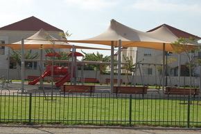
Iskate israel synthetic ice rink at yad binyamin
Yad Binyamin (Hebrew: יַד בִּנְיָמִין, lit. Binyamin Memorial) is a community settlement in central Israel. The seat of Nahal Sorek Regional Council, it is located adjacent to the junction of three major highways: Highway 3, Highway 6, and Highway 7. In 2015 it had a population of 3,849.
Contents
- Iskate israel synthetic ice rink at yad binyamin
- Map of Yad Binyamin Israel
- The malavsky aloof girls sing cantorial at yad binyamin israel
- History
- Transportation
- References
Map of Yad Binyamin, Israel
The malavsky aloof girls sing cantorial at yad binyamin israel
History
Yad Binyamin was founded on the land of the Ma'abara Nativa which was abandoned as a religious settlement and educational center in 1962 by Poalei Agudat Yisrael, in partnership with the municipality of Nahal Sorek. It was named after the former Minister of Postal Services, Binyamin Mintz, who had died the previous year. For many years, the community was a center of higher Jewish learning, based around the yeshiva.
Following the disengagement plan, around 200 families from Gush Katif moved into temporary pre-fabricated housing in Yad Binyamin. Some later moved to a new village named Ganei Tal after the former settlement by the same name. Many other families have moved to Netzer Harani.
Transportation
Yad Binyamin is located 3 kilometres (1.9 mi) from the Re'em Junction on Highway 3, and one kilometer from the intersection of Highway 6 and Highway 7. Israel Railways plans to upgrade the tracks of nearby Tel Aviv–Beersheba line and build a station at Kfar Menahem to serve the area, which is scheduled to be completed by January 2018. A number of Egged bus routes provide transport links to Jerusalem, Ashkelon, and other cities.