
Length 1,979 km Basin area 520,300 km² Source Mato Grosso Plateau | Basin area 531,250 km² Discharge 22,000 m³/s | |
 | ||
- average 9,680 m/s (341,846 cu ft/s) Basin 520,300 km2 (200,889 sq mi) | ||
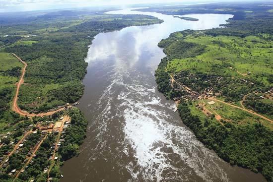
The Xingu River (Portuguese: Rio Xingu, [ɕĩˈɡu], /ʃiŋˈɡuː/ sheeng-GOO) is a 1,640 km (1,019 mi) river in north Brazil. It is a southeast tributary of the Amazon River.
Contents
Map of Xingu River, Brazil
Description and history
The first Indian Park in Brazil was created in the river basin by the Brazilian government in the early 1960s. This park marks the first indigenous territory recognized by the Brazilian government and it was the world's largest indigenous reserve on the date of its creation. Currently, fourteen tribes live on the reserve surviving with natural resources and extracting from the river most of what they need for food and water.
The Brazilian government is building the Belo Monte Dam, which will be the world's third-largest hydroelectric dam, on the Lower Xingu. Construction of this dam is under legal challenge by environment and indigenous groups, who assert the dam would have negative environmental and social impacts along with reducing the flow by up to 80% along a 100 kilometres (62 mi) stretch known as the "Big Bend" (Volta Grande). More than 450 fish species have been documented in the Xingu River Basin and it is estimated that the total is around 600 fish species, including many endemics. In the last 5 years alone, 21 new fish species have been described from the river. Many species are seriously threatened by the dam, including at least 26 fish species that are entirely restricted to the lower Xingu.
In the Upper Xingu region was a highly self-organized pre-Columbian anthropogenic landscape, including deposits of fertile agricultural terra preta, black soil in Portuguese, with a network of roads and polities each of which covered about 250 square kilometers.
Near the source of Xingu River is Culuene River, a 600 km tributary.