Elevation 360 m | Postal code 113200 Area 4,287 km² Area code 0413 | |
 | ||
Country People's Republic of China Points of interest The Qingyong Tomb, Hetu'ala City, Hemu Forest Park, Houshi National Forest Park, Man Nationality Old Street | ||
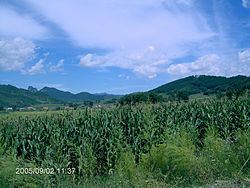
Xinbin Manchu Autonomous County (simplified Chinese: 新宾满族自治县; traditional Chinese: 新賓滿族自治縣; pinyin: Xīnbīn Mǎnzú Zìzhìxiàn), or simply Xinbin County (postal: Sinpin; simplified Chinese: 新宾县; traditional Chinese: 新賓縣), is one of the three counties under the administration of Fushun City, in the east of Liaoning Province, Northeast China. With a population of about 310,000, it covers an area of 4,287 square kilometres (1,655 sq mi).
Contents
Map of Xinbin, Fushun, Liaoning, China
Administrative Divisions
There are nine towns, one ethnic town and 10 townships in the county.
References
Xinbin Manchu Autonomous County Wikipedia(Text) CC BY-SA
