
Length 1.9 km (1.18 mi) Highest elevation 140.9 m (462.3 ft) Elevation 141 m | Width 1.4 km (0.87 mi) Highest point Yangwei Peak (羊尾岭) Area 189 ha | |
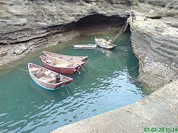 | ||
Xieyang Island (simplified Chinese: 斜阳岛; traditional Chinese: 斜陽島; pinyin: Xiéyáng Dǎo; Jyutping: ce4joeng4; literally: "setting sun") is a Chinese island in the Gulf of Tonkin, located 9 nautical miles (17 km; 10 mi) southeast of Weizhou Island. Administratively, it, along with Weizhou Island, forms the town of Weizhou, in Haicheng District, Beihai, Guangxi. It has an area of only 1.89 square kilometres (0.73 sq mi) and is of volcanic origin. The island may be described as appearing like a goat with its front legs crouched, and so in ancient times was also called "斜羊島". It is one of the tourist attractions of Beihai.
Map of Xieyang Island, Haicheng, Beihai, China
References
Xieyang Island Wikipedia(Text) CC BY-SA