
Country United States County Greene Elevation 932 ft (284 m) Zip code 45385 Local time Friday 9:01 AM | State Ohio Founded 1803 Time zone Eastern (EST) (UTC-5) Population 25,879 (2013) | |
 | ||
Weather 2°C, Wind NW at 13 km/h, 83% Humidity | ||
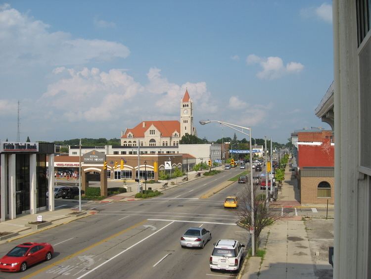
Xenia (/ˈziːnjə/ ZEEN-yə) is a city in and the county seat of Greene County, Ohio, United States. The municipality is located in southwestern Ohio 21 miles (34 km) from Dayton and is part of the Dayton Metropolitan Statistical Area, as well as the Miami Valley region. The name comes from the Greek word Xenia (ξενία), which means "hospitality".
Contents
- Map of Xenia OH 45385 USA
- History
- Tornadoes
- Railroads
- Geography
- Local government
- 2010 census
- 2000 census
- Education
- Media
- News
- Radio
- Film
- Literature
- Music
- Notable people
- References
Map of Xenia, OH 45385, USA
As of the 2010 census, the city had a population of 25,719. Xenia is the third largest city by population in Greene County, behind Fairborn and Beavercreek. It serves as the county seat of Greene County, being at the geographical center, and housing the County Courthouse, the County Sheriff's Department, Jail, and other Government departments. By population, it is the largest place in the United States whose name begins with the letter X.
History
Xenia was founded in 1803, the year Ohio was admitted into the Union. In that year, pioneer John Paul bought 2,000 acres (8.1 km2) of land from Thomas and Elizabeth Richardson of Hanover County, Virginia, for "1050 pounds current moneys of Virginia." Paul influenced county commissioners to locate the county seat on this land at the forks of the Shawnee Creeks.
Joseph C. Vance was named to survey the site and lay out the town. The following year, he bought the town site of 257 acres (1.04 km2) from John Paul for $250. The name of the new village was chosen in typically democratic fashion. Vance called a town meeting to discuss possible names. The committee had considered several suggestions without reaching any decision. Then the Rev. Robert Armstrong proposed the name "Xenia," meaning "hospitality" in Greek, because of the fine hospitality extended to him in this friendly community. When a tie vote occurred, Laticia Davis, wife of Owen Davis, was invited to cast the deciding ballot. She voted for "Xenia."
The first session of the Ohio General Assembly created Greene County from the Northwest Territory, embracing the homeland of the Shawnee Indians. Their chief tribal village was north of Xenia at Old Chillicothe, now called Old Town. The Shawnee war chief Tecumseh was born there in 1768.
William Beattie was Xenia's first businessman. In 1804, he opened a tavern which became a center of community affairs. In 1804, John Marshall built Xenia's first home. The first log school house was constructed in 1805, and, that same year, the Rev. James Towler became the town's first postmaster. The growing community soon attracted many pioneer industries - flour mills, sawmills, woolen mills, pork packing plants, oil mills, and tow mills.
Xenia was incorporated by an act of the legislature in 1817 and became a city in 1834. However, it was the arrival of the Little Miami Railroad (now the site of the Little Miami Scenic Trail, which passes through Xenia Station) in 1843 which gave the city its first industrial impetus. On March 2, 1850 the Ohio General Assembly rode from Columbus, Ohio to Xenia and back on the newly completed Columbus and Xenia Railroad.
President-Elect Abraham Lincoln made a brief appearance in the city as his inaugural train traveled from Cincinnati to Columbus on Wednesday morning, February 13, 1861. He gave a short speech which was not recorded by a traveling writer from the New York Times as it echoed the same sentiments that he had expressed before in his previous stops. According to the Times writer, "a very large crowd assembled, and amid the firing of a cannon and enthusiasm, Mr. Lincoln addressed them from the rear car, reiterating what he had said before.".
The town progressed rapidly during the mid-19th century. Artificial gas was provided in the 1840s and continued in use until natural gas was made available in 1905. The first fire engine house was built in 1831; the telephone came to Xenia in 1879; electricity in 1881 and a water works system in 1886. Xenia opened its first free public library in 1899. By 1900 the city was operating its own sewage system.
Xenia elected Cornelius Clark as its first mayor in 1834. On January 1, 1918, the current commission-manager plan succeeded the old form of municipal government.
Tornadoes
Xenia has a history of severe storm activity. According to local legend, the Shawnee Indians referred to the area as "the place of the devil wind" or "the land of the crazy winds" (depending upon the translation). Records of storms go back to the early 19th century. Local records show 20 tornadoes in Greene County since 1884.
On April 3, 1974 a tornado rated F5 on the Fujita scale cut a path directly through the middle of Xenia during the 1974 Super Outbreak, the second largest series of tornadoes in recorded history. The disaster killed 34 people (including two Ohio National Guardsmen who died days later in a related fire), injured an additional 1,150, destroyed almost half of the city's buildings, and left 10,000 people homeless. Five schools, including Xenia High School, Central Junior High School, McKinley Elementary, Simon Kenton Elementary, and Saint Brigid Catholic School were destroyed, as were nine churches and 180 businesses.
The city's plight was featured in the national news, including a 1974 NBC television documentary, Tornado!, hosted by Floyd Kalber. President Richard Nixon visited stricken areas of Xenia following the devastation. Comedian Bob Hope organized a benefit for Xenia and, in appreciation, the new Xenia High School Auditorium was named the "Bob Hope Auditorium." In recognition of their coverage of this tornado, the staff of the Xenia Daily Gazette won the Pulitzer Prize for Spot News Reporting in 1975.
Xenia was struck by an F2 tornado on April 25, 1989 and again by an F4 tornado on September 20, 2000. The 1989 tornado caused over $2 million in damage, but no one was killed. The twister of 2000 killed one person, and injured 100 people. This tornado followed a path roughly parallel to the 1974 tornado.
Xenia currently has a system of tornado sirens. After the 1974 tornado outbreak, the city purchased a system of Federal Signal Thunderbolt Sirens for warning. During the 2000 tornado strike, the lack of backup power silenced the sirens, so the city purchased Federal Signal 2001-SRN series sirens with battery backup. Most of Xenia's old sirens are still standing, but not operational.
Railroads
Xenia originally hosted several lines owned by the Baltimore & Ohio (B&O) and Pennsylvania (PRR) railroads. All lines have since been abandoned, the last being dismantled by 1989.
The lines that previously served Xenia were:
The roadbeds of five of Xenia's six rail lines were converted for rail trail use. The one exception — the B&O line west of town — was not converted because it closely paralleled the PRR mainline for most if its length. The large number of rail trails resulted in Xenia being referred to as the Bicycle Capital of the Midwest.
Xenia was also served by two interurban railways until the 1940s:
Geography
Xenia is centrally located in the "transportation triangle" formed by three major interstate highways: I-70, I-71, and I-75. These north-south, east-west arteries are within minutes of Xenia via U.S. Routes 35, 42, and 68, tying the community to one of the nation's largest 90-minute highway markets. Before the creation of the U.S. Interstate Highway system, U.S. 68 was one of the main southward routes from Detroit, Michigan. Within Xenia, U.S. 68 is named "Detroit Street".
Xenia is at 39°41′1″N 83°56′17″W (39.68, -83.94).
According to the United States Census Bureau, the city has a total area of 13.29 square miles (34.42 km2), of which, 13.28 square miles (34.40 km2) is land and 0.01 square miles (0.03 km2) is water.
Local government
The Xenia City Council exercises the powers and authority of a municipal corporation as determined by the constitution of the State of Ohio and the Charter and ordinances of the City of Xenia. The City Council of Xenia, Ohio, is composed of seven elected council members, including one mayor. Council members are each elected for one four-year term of office.
City Council Members and term start years:
Others:
2010 census
As of the census of 2010, there were 25,719 people, 10,390 households, and 6,631 families residing in the city. The population density was 1,936.7 inhabitants per square mile (747.8/km2). There were 11,424 housing units at an average density of 860.2 per square mile (332.1/km2). The racial makeup of the city was 82.0% White, 13.4% African American, 0.4% Native American, 0.5% Asian, 0.5% from other races, and 3.2% from two or more races. Hispanic or Latino of any race were 1.7% of the population.
There were 10,390 households of which 32.3% had children under the age of 18 living with them, 42.6% were married couples living together, 16.3% had a female householder with no husband present, 4.9% had a male householder with no wife present, and 36.2% were non-families. 31.0% of all households were made up of individuals and 12.9% had someone living alone who was 65 years of age or older. The average household size was 2.39 and the average family size was 2.98.
The median age in the city was 37.1 years. 24.8% of residents were under the age of 18; 9.1% were between the ages of 18 and 24; 25.6% were from 25 to 44; 24.9% were from 45 to 64; and 15.7% were 65 years of age or older. The gender makeup of the city was 47.2% male and 52.8% female.
2000 census
As of the census of 2000, there were 24,164 people, 9,378 households, and 6,527 families residing in the city. The population density was 1,989.3 people per square mile (767.9/km²). There were 9,924 housing units at an average density of 817.0 per square mile (315.4/km²). The racial makeup of the city was 83.30% White, 13.51% African American, 0.34% Native American, 0.29% Asian, 0.05% Pacific Islander, 0.53% from other races, and 1.98% from two or more races. Hispanic or Latino of any race were 1.09% of the population.
There were 9,378 households out of which 34.2% had children under the age of 18 living with them, 50.2% were married couples living together, 15.5% had a female householder with no husband present, and 30.4% were non-families. 26.2% of all households were made up of individuals and 11.1% had someone living alone who was 65 years of age or older. The average household size was 2.51 and the average family size was 3.02.
In the city the population was spread out with 27.1% under the age of 18, 9.6% from 18 to 24, 28.5% from 25 to 44, 21.3% from 45 to 64, and 13.5% who were 65 years of age or older. The median age was 34 years. For every 100 females there were 90.5 males. For every 100 females age 18 and over, there were 84.4 males.
The median income for a household in the city was $36,457, and the median income for a family was $43,046. Males had a median income of $34,497 versus $24,094 for females. The per capita income for the city was $16,481. About 8.9% of families and 11.6% of the population were below the poverty line, including 14.8% of those under age 18 and 9.4% of those age 65 or over.
Education
The Xenia Community School District has 5 elementary, 2 middle, and 1 high school:
Private schools in Xenia:
Media
Xenia is part of the Dayton media market, the 64th-largest media market in the United States.
News
The main newspaper in Xenia is the Xenia Daily Gazette, founded in 1868. The Gazette is published six days a week. A community-based online source, Xenia's Word on the Street, is also available. The larger Dayton Daily News, which covers the entire Dayton metro area, includes a community section for Xenia in both the printed and online versions.
Radio
Radio stations based in Xenia: