
Country United States Time zone Central (CST) (UTC-6) Zip code 68466 Local time Thursday 10:25 AM | Elevation 1,240 ft (378 m) Area code(s) 402 Population 1,430 (2013) | |
 | ||
Weather 7°C, Wind NW at 16 km/h, 72% Humidity | ||
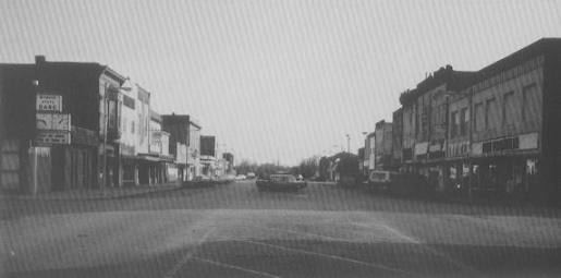
Wymore is a city in Gage County, Nebraska, United States. The population was 1,457 at the 2010 census.
Contents
- Map of Wymore NE 68466 USA
- History
- Geography
- 2010 census
- 2000 census
- Education
- Attractions
- Notable people
- References
Map of Wymore, NE 68466, USA
History
Wymore was platted in 1881 as a railroad town, on land donated by Sam Wymore. The "Welsh Capitol of the Great Plains," Wymore became home to generations of immigrants from Wales, who continued their culture in day-to-day life, founding a Welsh-language church, school and cemetery, as well as preserving the Welsh traditions of poetry, dance, and intricate music in minor.
In 2000, the Wymore Welsh Heritage Project was founded to preserve the legacy of these early settlers. It has since expanded to include a museum, an archive of genealogical records, and one of the largest Welsh-language libraries in North America.
Wymore is home to the Southern Raiders, a class C school that serves students from Barneston, Holmesville, Blue Springs, Wymore, and Liberty. The school has won 2 state championships, both in wrestling (1974 and 1980). The Wymore Arbor State baseball ballfield has one of the few covered, behind-the-plate bleachers in the state.
Wymore, Nebraska is also the burial place of author and anthropologist R. Clark Mallam, whose book, Indian Creek Memories; A Sense of Place is set in and around the town.
Geography
Wymore is located at 40°7′22″N 96°39′56″W (40.122765, -96.665494).
According to the United States Census Bureau, the city has a total area of 1.90 square miles (4.92 km2), of which, 1.87 square miles (4.84 km2) is land and 0.03 square miles (0.08 km2) is water.
2010 census
As of the census of 2010, there were 1,457 people, 647 households, and 369 families residing in the city. The population density was 779.1 inhabitants per square mile (300.8/km2). There were 755 housing units at an average density of 403.7 per square mile (155.9/km2). The racial makeup of the city was 95.3% White, 0.1% African American, 0.8% Native American, 1.4% from other races, and 2.3% from two or more races. Hispanic or Latino of any race were 2.4% of the population.
There were 647 households of which 26.4% had children under the age of 18 living with them, 43.6% were married couples living together, 9.6% had a female householder with no husband present, 3.9% had a male householder with no wife present, and 43.0% were non-families. 37.9% of all households were made up of individuals and 22.1% had someone living alone who was 65 years of age or older. The average household size was 2.18 and the average family size was 2.90.
The median age in the city was 46.8 years. 22.2% of residents were under the age of 18; 5.6% were between the ages of 18 and 24; 19.7% were from 25 to 44; 29.2% were from 45 to 64; and 23.3% were 65 years of age or older. The gender makeup of the city was 46.3% male and 53.7% female.
2000 census
As of the census of 2000, there were 1,656 people, 713 households, and 444 families residing in the city. The population density was 869.2 people per square mile (334.8/km²). There were 776 housing units at an average density of 407.3 per square mile (156.9/km²). The racial makeup of the city was 96.68% White, 0.12% African American, 1.51% Native American, 0.42% Asian, 0.12% Pacific Islander, 0.18% from other races, and 0.97% from two or more races. Hispanic or Latino of any race were 1.27% of the population.
There were 713 households out of which 27.3% had children under the age of 18 living with them, 49.4% were married couples living together, 9.0% had a female householder with no husband present, and 37.7% were non-families. 35.1% of all households were made up of individuals and 20.6% had someone living alone who was 65 years of age or older. The average household size was 2.25 and the average family size was 2.87.
In the city, the population was spread out with 23.8% under the age of 18, 7.0% from 18 to 24, 24.2% from 25 to 44, 19.7% from 45 to 64, and 25.4% who were 65 years of age or older. The median age was 42 years. For every 100 females there were 87.5 males. For every 100 females age 18 and over, there were 84.8 males.
As of 2000 the median income for a household in the city was $25,947, and the median income for a family was $33,150. Males had a median income of $26,200 versus $18,800 for females. The per capita income for the city was $13,978. About 12.2% of families and 13.8% of the population were below the poverty line, including 22.0% of those under age 18 and 7.3% of those age 65 or over.
Education
Wymore Public Schools are part of the Southern School District. There is one elementary school and one high school in the district. The schools are Southern Elementary School and Southern High School.
Southern High School is located in Wymore.
Gene Haddix is the Superintendent of Schools.
Attractions
The Wymore Welsh Heritage Centre includes the Welsh Language library (cataloged in English as well as Welsh), oral and written histories of early settlers and artifacts of Welsh life in the Great Plains.
The Pleasantview Schoolhouse is a fully restored schoolhouse from the first decade of the 20th century, now a museum. It is home of the bi-annual "Day at a Country School" where students are invited to learn about Welsh heritage and language from teachers attired in traditional Welsh Costume.
Bethel Cemetery is the final resting place of many of Wymore's Welsh Founders. Many of the tombstones date to the mid-to-late 19th century and bear inscriptions in Welsh.