
Postcode(s) 3240 Population 569 (2011 census) | Wurdiboluc ModewarreGherang Postal code 3240 | |
 | ||
Location 33 km (21 mi) SW of Geelong97 km (60 mi) SW of Melbourne | ||
Wurdiboluc is a rural locality in the Surf Coast Shire, Victoria, Australia. In the 2011 census, Wurdiboluc and the surrounding districts (including Modewarre and Buckley) had a population of 569 people.
Map of Wurdiboluc VIC 3241, Australia
A post office was opened in July 1927 as Wurdiboluc State School PO. A receiving office had previously existed since around 1902. It was renamed Wurdiboluc PO in 1932 and closed on 30 September 1966.
Wurdiboluc once had a state school; the date of its closure is unknown. In 1902, a proposal was made to amalgamate the school with that at nearby Wensleydale, on a new central site; instead, the Wensleydale school was closed in 1903, and the Department of Education arranged to transport the Wensleydale students to the Wurdiboluc school.
Newspaper advertisements from the 1860s refer to a "Wurdee Boluc Hotel" or "Reeves' Telegraph Hotel" at Wurdiboluc.
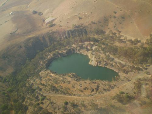
Wurdee Boluc Reservoir, the main water storage for the city of Geelong, is located in Wurdiboluc. The reservoir has picnic facilities, and is also used for fishing. The adjacent Wurdee Boluc Water Treatment Plant is responsible for filtering, disinfecting and fluoridating Geelong's water supply.