
Population 271 (2011 census) Civil parish Wressle Postcode district YO8 | OS grid reference SE709315 Local time Thursday 8:12 AM | |
 | ||
Unitary authority Weather 6°C, Wind W at 6 km/h, 93% Humidity | ||
Wressle (with spelling variations of Wressell, and Wressel, in Leland's 'Itinary' Wreshil, in the Domesday Book Weresa) is a village and civil parish in the East Riding of Yorkshire, England, lying on the eastern bank of the River Derwent approximately 3 miles (5 km) north-west of Howden.
Contents
Map of Wressle, Selby, UK
Wressle village has a late 18th-century church, St John, and on the western fringe of the village is the Grade I listed structure and scheduled monument, the ruins of Wressle Castle. Wressle railway station is located within the village.
The parish includes the hamlets of Brind, Newsholme and Loftshome. Wressle lies within the Parliamentary constituency of Haltemprice and Howden an area that mainly consists of middle class suburbs, towns and villages. The area is affluent, placed as the 10th most affluent in the country in a Barclays Private Clients survey, and has one of the highest proportions of owner-occupiers in the country.
Geography
The civil parish of Wressle is bounded by the civil parishes of Hemingbrough and Cliffe in the county of North Yorkshire to the west, separated by the River Derwent; by Bubwith to the north, separated by the Fleet Dike; by Spaldington and Howden to the east; and by Asselby and Barmby on the Marsh to the south.
The civil parish contains Wressle and the hamlets of Brind and Newsholme. The place of Loftsome lies less than 0.6 miles (1 km) south of Wressle on the bank of the Derwent. The Hull to Selby railway line runs east-west through the parish, passing Wressle on the southern edge, and the A63 also passes east-west through the southern part of the parish, skirting Newsholme, and passing Loftsome Bridge. The parish contains predominately agricultural land at around 16 feet (5 m) above sea level.
According to the 2011 UK Census, Wressle parish had a population of 271, an increase on the 2001 UK Census figure of 261.
Wressle Castle
Wressle Castle was a quadrangular castle originally was built for Thomas Percy in around 1380.
Wressle village
Wressle was listed as a Manor (Weresa) in the Domesday survey.
An early church is thought to have been destroyed during the English Civil War as it represented a potential fortification; church services were then held in the chapel in the remains of Wressle Castle, until that was destroyed by fire (1796). The parish church of St John of Beverley, now a Grade II listed building, was built in 1799 of brick with stone dressings, as a replacement.
Other 18th-century buildings still extant include the Castle Farmhouse (1796) built to house the farmer after the fire in Wressle castle; and the Long Barn (late 18th century) near to the castle site, Holly Cottage in Wressle village (mid-18th century); all built of brick. Rowland Hall, east of the village was built in the late 18th century in brick with stone dressings.
In 1840 the Hull and Selby Railway was opened, passing south of Wressle, with a cast iron bridge over the Derwent; services calling at Wressle are recorded as early as 1843, with a full train service at Wressle station by 1855. A school with an attached schoolmaster's house was erected in 1854.
A windmill was built at Mill Farm, east of the village church in the 19th century, by 1890 it was out of use.
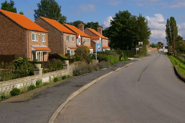
The village has had minimal urban growth in the industrial and modern age. In 1997 planning permission was obtained for a new small street of 5 houses off main street, named 'Derwent Court'.
Loftsome and Loftsome Bridge were small hamlets in the parish of Wressle. The Derwent was once crossed by a ferry at loftsome. A swing bridge crossing of the Derwent was built at Loftsome in 1804, operated as a toll bridge.
There has been an inn at Loftsome Bridge since at least the 1800s. By 1823 the inn was known as the Loftsome Bridge Inn.
In the 1870s Loftsome's population was 20.
The original loftsome bridge remained in use to the early 1930s, at which time a new bridge was built for the Hull-Selby road (part of the A63).
(In the parish of Barmby on the Marsh) In the early 1980s Yorkshire Water constructed a water supply treatment works "Loftsome Water Treatment Works" approximately 0.6 miles (1 km) southwest of Loftsome on the banks of the Derwent. The site was refurbished and upgraded in 1994, including ozone treatment, giving a capacity of 114,000 cubic metres (4,000,000 cu ft) per day, in 2005/6 the site added additional treatment units to deal with increased pesticide and trihalomethane content from the Derwent.
In the late 2000s Yorkshire water had two 1.3 MW wind turbines installed at its site in Loftsome .