
Time zone CET (UTC+1) Website www.woudenberg.eu Area code 033 | Elevation 3 m (10 ft) Postcode 3930–3931 Area 36.72 km² Local time Thursday 7:34 AM | |
 | ||
Weather 7°C, Wind NW at 10 km/h, 85% Humidity | ||
Woudenberg is a municipality and a town in the central Netherlands, in the province of Utrecht.
Contents
Map of Woudenberg, Netherlands
There are still forests in the western part of the municipality. The Pyramid of Austerlitz is located here.
Dutch Topographic map of the municipality of Woudenberg, 2013.
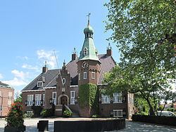
The town Woudenberg
The name Woudenberg refers to a forested hill; nowadays the town lies in an agricultural area about 8 km south of Amersfoort. The main sources of income were the raising of livestock and the cultivation of tobacco. Currently, most people work out of town, mostly in the surrounding towns of Amersfoort, Utrecht and Veenendaal.
Tourism
Because of the many attractions nearby, such as the Grebbe, the Pyramid of Austerlitz and the Henschotermeer, Woudenberg is visited by many tourists. That can also be derived from the number of tourist accommodation, which is 12.