
Country United States FIPS code 16-88480 Elevation 811 m Zip code 83876 Local time Wednesday 8:50 PM | Time zone Pacific (PST) (UTC-8) GNIS feature ID 0398386 Area 49 ha Population 254 (2013) Area code 208 | |
 | ||
Weather 12°C, Wind SE at 10 km/h, 55% Humidity | ||
Rockford bay full moon flight over worley idaho
Worley is a city in southwestern Kootenai County, Idaho, United States. The population was 257 at the 2010 census, up from 223 in 2000. The city is within the Coeur d'Alene Indian Reservation.
Contents
- Rockford bay full moon flight over worley idaho
- Map of Worley ID 83876 USA
- Geography
- 2010 census
- 2000 census
- Facilities
- References
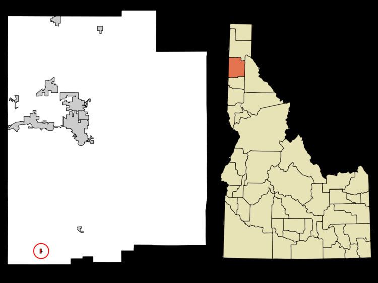
Map of Worley, ID 83876, USA
Geography
Worley is located at 47°23′57″N 116°55′10″W (47.399124, -116.919410), at an elevation of 2,661 feet (811 m) above sea level.
According to the United States Census Bureau, the city has a total area of 0.19 square miles (0.49 km2), all land.
To the south of the village are gentle hills heavily wooded with sweet scented evergreens and a year around community of deer, elk, wild turkey and black bears. In the summer butterflies and colorful dragon flies and crickets visit the 17 acre tribal community gardens located off to the North of Worley.
2010 census
As of the census of 2010, there were 257 people, 104 households, and 57 families residing in the city. The population density was 1,352.6 inhabitants per square mile (522.2/km2). There were 116 housing units at an average density of 610.5 per square mile (235.7/km2). The racial makeup of the city was 56.0% White, 0.8% African American, 28.0% Native American, 1.6% from other races, and 13.6% from two or more races. Hispanic or Latino of any race were 5.8% of the population.
There were 104 households of which 27.9% had children under the age of 18 living with them, 36.5% were married couples living together, 7.7% had a female householder with no husband present, 10.6% had a male householder with no wife present, and 45.2% were non-families. 34.6% of all households were made up of individuals and 10.5% had someone living alone who was 65 years of age or older. The average household size was 2.47 and the average family size was 3.19.
The median age in the city was 37.3 years. 26.1% of residents were under the age of 18; 10.9% were between the ages of 18 and 24; 24.1% were from 25 to 44; 25.3% were from 45 to 64; and 13.6% were 65 years of age or older. The gender makeup of the city was 52.1% male and 47.9% female.
2000 census
As of the census of 2000, there were 223 people, 81 households, and 54 families residing in the city. The population density was 1,178.6 people per square mile (453.2/km²). There were 95 housing units at an average density of 502.1 per square mile (193.1/km²). The racial makeup of the city was 69.06% White, 0.45% African American, 28.70% Native American, 0.45% from other races, and 1.35% from two or more races. Hispanic or Latino of any race were 2.69% of the population.
There were 81 households out of which 33.3% had children under the age of 18 living with them, 55.6% were married couples living together, 8.6% had a female householder with no husband present, and 32.1% were non-families. 24.7% of all households were made up of individuals and 13.6% had someone living alone who was 65 years of age or older. The average household size was 2.75 and the average family size was 3.29.
In the city, the population was spread out with 28.3% under the age of 18, 9.0% from 18 to 24, 26.0% from 25 to 44, 16.6% from 45 to 64, and 20.2% who were 65 years of age or older. The median age was 36 years. For every 100 females there were 93.9 males. For every 100 females age 18 and over, there were 88.2 males.
The median income for a household in the city was $27,500, and the median income for a family was $32,813. Males had a median income of $33,750 versus $20,833 for females. The per capita income for the city was $10,975. About 17.2% of families and 19.8% of the population were below the poverty line, including 23.1% of those under the age of eighteen and none of those sixty five or over.
Facilities
Children are able to attend preschool through grade 12 in Plummer, Idaho or attend the Tribal School in Desmet, Idaho with free bus service.
The CDA Nation provides health care, in addition to regular free bus service for all people to Spokane, CDA, and rural routes on the rez every day from Worley.
Worley is well known for its numerous fireworks stands and assigned places to detonate them. The private fireworks in Worley rival those of big cities on the 4th of July as people flock to Worley from 3 states to purchase astonishing complex fireworks at low prices.