
Country Canada Regional municipality Waterloo Time zone EST (UTC-5) Population 23,145 (2011) Area code Area codes 519 and 226 | Province Ontario Settled 1798 Website www.woolwich.ca Mayor Sandy Shantz | |
 | ||
Weather 9°C, Wind E at 8 km/h, 61% Humidity | ||
The Township of Woolwich is a rural township in Southwestern Ontario, Canada. It is part of the Regional Municipality of Waterloo, immediately to the north and east of the City of Waterloo. It is bounded by the cities of Kitchener, Waterloo, and Cambridge.
Contents
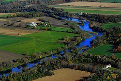
Map of Woolwich, ON, Canada
The Township of Waterloo was established in its present configuration by the Regional Municipality of Waterloo Act 1972, which created a regional government structure and established limits of the local municipalities in Waterloo area effective January 1, 1973.
History
Woolwich Township began to be settled in the late 1700s, with a certain William Wallace being one of the first settlers arriving in 1798. The township was named in honour of a government surveyor.
Communities
Woolwich consists of an extensive rural area along with residential communities and industrial/commercial areas. The residential communities include: Elmira, St. Jacobs, Breslau, Conestogo, Heidelberg, Maryhill, North Woolwich, Bloomingdale, Weissenburg, West Montrose, Floradale, Winterbourne, Crowsfoot Corners, Mundil, Weber, Shanz Station, Martin Grove Village, Eldale, and Zuber Corners.
The industrial/commercial areas include: South Breslau Industrial Area, Bast Place Industrial/Commercial Area, Stockyards Industrial Commercial Area, Shantz Station Commercial Area and Nelson Monuments Industrial Area.
The three largest settlement areas offering a range of residential, industrial, commercial and recreational uses are in Elmira, St. Jacobs and Breslau (which is the fastest growing town in the township).
The Township contains an area of approximately 31,912 hectares (78,854 acres), with population of approximately 23,410.
Trails
Woolwich Township has eleven trails totalling more than 80 kilometres (50 mi).
Transport
Airport
Bus
Rail Services
Highways
Demographics
Population trend:
Private dwellings occupied by usual residents: 7913 (total dwellings: 8046)