
Catchment area 6 km² Managing agency Sutherland Shire | Frozen never | |
 | ||
Similar Georges River, Towra Point Nature R, Balmain Reservoir, Duck Creek, Vineyard Creek | ||
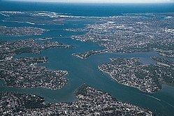
The Woolooware Bay is a bay on the lower estuarine Georges River in southern Sydney, in the state of New South Wales, Australia.
Contents
Map of Woolooware Bay, Kurnell NSW 2231, Australia
Location and featuresEdit
The bay is located near where the Georges River empties into Botany Bay, southeast of the Captain Cook Bridge. The bay's catchment area is bound by Botany Bay to the north, Bate Bay sub-catchment to the east, Gwawley Bay sub-catchment to the west and Port Hacking sub-catchment to the south. The bay is surrounded by the suburbs of Kurnell to the east, Woolooware to the south, and Taren Point and Caringbah to the west of the bay's shore. Mangrove swamps were traditionally located around the bay area. Some were reclaimed to create parks and playing fields including Endeavour Field (Toyota Park), Woolooware Golf Course and Cronulla Golf Course.