
OS grid reference SO520684 Local time Wednesday 4:58 PM | Unitary authority Sovereign state United Kingdom Dialling code 01584 | |
 | ||
Weather 13°C, Wind N at 18 km/h, 56% Humidity | ||
Woofferton is a village to the south of Ludlow, in Shropshire, England. It is one of Shropshire's most southerly villages and lies on the border with Herefordshire. It is part of the civil parish of Richard's Castle. The larger Herefordshire village of Brimfield is just over the border to the south.
Contents
Map of Woofferton, Ludlow, UK
Transport
Woofferton is at the crossroads of the A49 Ludlow-Leominster road (north-south), the A456 road that strikes eastwards and the B4362 (westwards). It was formerly the site of Woofferton railway station (on the Shrewsbury and Hereford Railway) and Woofferton Junction which served the (now closed) Tenbury & Bewdley Railway.
The Welsh Marches Line runs through the currently closed station, with Arriva Trains Wales running on the section without intermediate stations between Leominster and Ludlow.
Places of interest
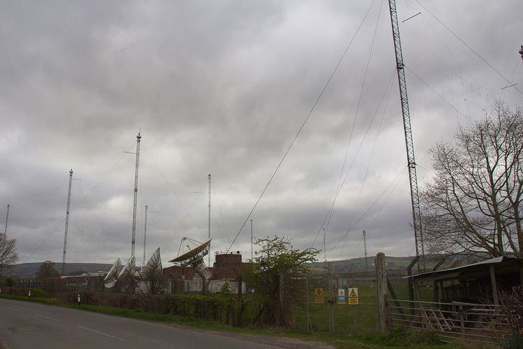
It is best known for the Woofferton transmitting station (a notable feature of the area's landscape) and a Travelodge. The public house there - the "Salwey Arms" - is the most southerly in the county.