
Population 4,089 (2011 census) Postcode(s) 4019 | Established 1971 Woody Point Moreton Bay Postal code 4019 | |
 | ||
Weather 18°C, Wind S at 14 km/h, 82% Humidity | ||
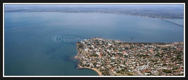
Woody Point is a residential suburb of the Moreton Bay Region at the south-east of the Redcliffe peninsula, approximately 24 kilometres (15 mi) north-northeast of Brisbane, the state capital of Queensland, Australia. It was formerly a banana plantation.
Contents
- Map of Woody Point QLD 4019 Australia
- History
- Heritage listings
- Amenities
- Demographics
- Attractions and features
- References
Map of Woody Point QLD 4019, Australia
History
In 1799, Matthew Flinders landed on the peninsula and named the location Red Cliff Point after the colours in the cliffs. In 1823 the peninsula was selected as the site of Queensland's first penal colony but, by 1825 the prisoners were moved further up the Brisbane River to escape the mosquitoes and the resistance from displaced local Aboriginal Australians. Redcliffe was once a small seaside retreat 40 km north of Brisbane. When the Hornibrook and Houghton Highways linked Brighton, an outer Brisbane suburb, to the Redcliffe peninsula, Redcliffe then became much more accessible and grew as part of Brisbane's suburban sprawl.
Woody Point's Apex Park & Bicentennial Park were constructed by reclaiming land along the foreshore in the 1970s.
Heritage listings
Heritage-listed sites at Woody Point including Woody Point Memorial Hall along the Hornibrook Esplanade.
Amenities
Woody Point's current renovations include the construction of high-rise apartment buildings overlooking Bramble Bay, Moreton Bay, The Port of Brisbane and the Ted Smout Highway. Until recently, restaurants and cafes were very limited in the suburb, however currently Woody Point boasts some of the most highly rated and recognized restaurants on the Redcliffe Peninsula including The Steak & Crabhouse & Masala Point Cafe.
The closest shopping centre is either Margate Village, some 2 km north or Bayside Plaza in Clontarf, some 3 km southwest. Woody Point accommodates localized convenience retail, a corner store, takeaways, a medical clinic and pharmacy & an Australian Post branch within its Woody Point Village.
Demographics
In the 2011 census, Woody Point recorded a population of 4,089 people, 51.5% female and 48.5% male. The median age of the Woody Point population was 46 years, 9 years above the national median of 37. 71.5% of people living in Woody Point were born in Australia. The other top responses for country of birth were England 6.3%, New Zealand 6.3%, Scotland 1.2%, South Africa 0.9%, Canada 0.6%. 89.3% of people spoke only English at home; the next most common languages were 0.6% Spanish, 0.4% Russian, 0.4% German, 0.4% French, 0.3% Dutch.
Attractions and features
Clubs on the point include Eildon Croquet Club, Redcliffe Outrigger Canoe Club and Humpybong Yacht Club.