
Airport type Public 9/27 3,797 Address McCrory, AR 72101, USA Phone +1 870-347-5206 | Elevation AMSL 200 ft / 61 m 3,797 1,157 Elevation 61 m | |
 | ||
Similar Woodruff County Jail, White County - Arkansas, Prairie County Sheriff's, St Francis County Sheriff | ||
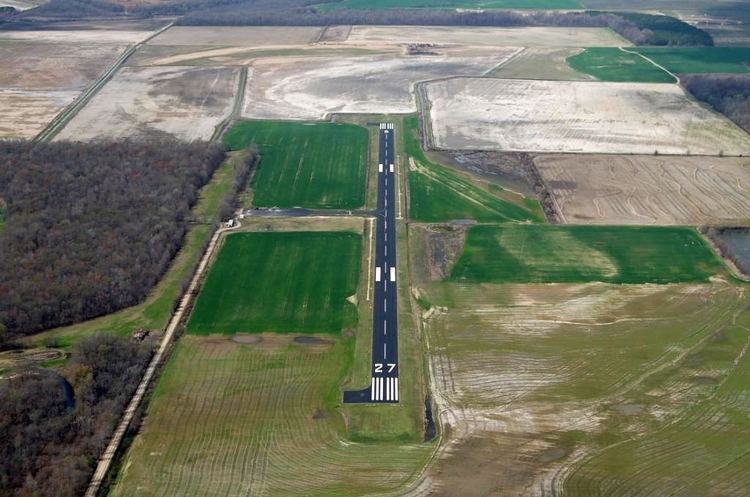
Woodruff County Airport (FAA LID: M60) is a county-owned public-use airport in Woodruff County, Arkansas, United States. It is located four nautical miles (5 mi, 7 km) east of the central business district of Augusta, Arkansas.
This airport is included in the FAA's National Plan of Integrated Airport Systems for 2011–2015, which categorized it as a general aviation airport.
Facilities and aircraft
Woodruff County Airport covers an area of 100 acres (40 ha) at an elevation of 200 feet (61 m) above mean sea level. It has one runway designated 9/27 with an asphalt surface measuring 3,797 by 75 feet (1,157 x 23 m). For the 12-month period ending April 30, 2008, the airport had 5,500 general aviation aircraft operations, an average of 15 per day.
References
Woodruff County Airport Wikipedia(Text) CC BY-SA