
Time zone Central (CST) (UTC-6) Population 816 (2010) | Elevation 961 ft (293 m) Area code(s) 608 Local time Wednesday 5:43 AM | |
 | ||
Weather 6°C, Wind E at 6 km/h, 68% Humidity | ||
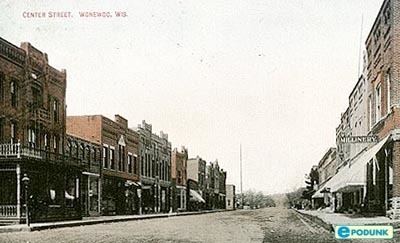
Wonewoc is a village in Juneau County, Wisconsin, United States, along the Baraboo River. The population was 816 at the 2010 census.
Contents
- Map of Wonewoc WI 53968 USA
- History
- Geography
- 2010 census
- 2000 census
- Government
- Religion
- Tourism and recreation
- Notable people
- References
Map of Wonewoc, WI 53968, USA
History
The name “Wonewoc” is of Indigenous American origin, probably meaning "howling hills". However, at the time of colonization, the site and subsequent town were known to the native Hocąk (Winnebago) people as Wonį́wąk, which in their language means, "wicked, bad." How this site received such a name is lost to prehistory. George and Lucinda Willard first settled the area in 1851. The town was incorporated as a village in 1878, and once the railroad was built village growth exploded. The population of the town was largely settled by Yankee colonists from New England, according to the 1860 census.
When the railroad era ended Wonewoc’s growth halted. Wonewoc is now a quiet, scenic town known for its beauty and close-knit community.
Geography
Wonewoc is located in the southernmost part of Juneau County, in an unglaciated region of Wisconsin. The resulting landscape is filled with jagged bluffs, with the scenic Baraboo River flowing next to the town.
The Wonewoc Formation was first described here and named for the village.
Wonewoc is located at 43°40' North, 90°14' West (43.654, -90.223).
According to the United States Census Bureau, the village has a total area of 1.11 square miles (2.87 km2), all of it land.
2010 census
As of the census of 2010, there were 816 people, 359 households, and 215 families residing in the village. The population density was 735.1 inhabitants per square mile (283.8/km2). There were 406 housing units at an average density of 365.8 per square mile (141.2/km2). The racial makeup of the village was 97.9% White, 0.5% African American, 0.1% Native American, 0.4% Asian, 0.2% from other races, and 0.9% from two or more races. Hispanic or Latino of any race were 1.3% of the population.
There were 359 households of which 30.4% had children under the age of 18 living with them, 43.5% were married couples living together, 12.0% had a female householder with no husband present, 4.5% had a male householder with no wife present, and 40.1% were non-families. 34.3% of all households were made up of individuals and 17.8% had someone living alone who was 65 years of age or older. The average household size was 2.25 and the average family size was 2.84.
The median age in the village was 40.8 years. 23.9% of residents were under the age of 18; 6.8% were between the ages of 18 and 24; 24.2% were from 25 to 44; 26.1% were from 45 to 64; and 19.1% were 65 years of age or older. The gender makeup of the village was 46.3% male and 53.7% female.
2000 census
As of the census of 2000, there are 834 people, 369 households, and 225 families residing in the village. The population density is 803.3 inhabitants per square mile (309.6/km²). There are 392 housing units at an average density of 377.6 per square mile (145.5/km²). The racial makeup of the village is 98.92% White, 0.00% Black or African American, 0.36% Native American, 0.36% Asian, 0.00% Pacific Islander, 0.00% from other races, and 0.36% from two or more races. 0.36% of the population are Hispanic or Latino of any race.
There are 369 households out of which 27.9% have children under the age of 18 living with them, 44.7% are married couples living together, 11.9% have a female householder with no husband present, and 39.0% are non-families. 35.2% of all households are made up of individuals and 19.0% have someone living alone who is 65 years of age or older. The average household size is 2.23 and the average family size is 2.82.
In the village, the population is spread out with 23.4% under the age of 18, 9.4% from 18 to 24, 25.5% from 25 to 44, 19.2% from 45 to 64, and 22.5% who are 65 years of age or older. The median age is 39 years. For every 100 females there are 83.3 males. For every 100 females age 18 and over, there are 85.2 males.
The median income for a household in the village is $28,393, and the median income for a family is $36,667. Males have a median income of $28,611 versus $20,125 for females. The per capita income for the village is $18,957. 9.6% of the population and 3.9% of families are below the poverty line. Out of the total population, 12.2% of those under the age of 18 and 13.1% of those 65 and older are living below the poverty line.
Government
The village government is made up of a president and board of trustees. The president is Lee Kutcher, and the board of trustees include Rick Field, Nick Baldwin, Kevin Jennings, Sherry Roehling, Amy Miller, and Scott Jennings. The chief of police is Julie Ott.
Religion
The Wonewoc Spiritualist Camp is in Wonewoc. Within the village are three churches: United Methodist Church, St. Paul’s Lutheran Church and St. Jerome’s Catholic Church.
Tourism and recreation
Wonewoc is the midpoint of the 400 Trail, one of the area's many trails used by bikers, hikers, horse riders and snowmobile enthusiasts. The Baraboo River is used for canoeing and kayaking, as are the nearby lakes, Dutch Hollow and Lake Redstone, which also offer fishing, swimming, and other water sports. Wonewoc has a public pool, camping, and parks.