
Country United States County Lycoming Incorporated 1824 Elevation 170 m Population 2,707 (2000) | State Pennsylvania Settled 1777 Time zone Eastern (EST) (UTC-5) Area 50.7 km² Local time Tuesday 9:42 PM | |
 | ||
Weather 15°C, Wind W at 13 km/h, 58% Humidity | ||
Wolf Township is a township in Lycoming County, Pennsylvania, United States. The population was 2,707 at the 2000 census. It is part of the Williamsport, Pennsylvania Metropolitan Statistical Area.
Contents
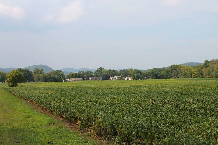
- Map of Wolf Township PA USA
- History
- Quarries
- Early settlers and industry
- Geography
- Demographics
- References
Map of Wolf Township, PA, USA
History
Wolf Township was formed from part of Muncy Township by the Pennsylvania General Assembly in September 1834. The township is named for George Wolf who was the governor of Pennsylvania from 1829 to 1835. The boroughs of Hughesville and Picture Rocks are on land that was taken from Wolf Township.
Wolf Township today has grown to a population of 2,707 residents as of the 2000 census. This is up from 734 residents at the census of 1890.
Quarries
The geology of Wolf Township played a role in its history. Limestone was quarried west of Hughesville for use as lime. Lime is used in large quantities as building and engineering materials (including limestone products, concrete and mortar) and as chemical feedstocks, among other uses. Lime industries and the use of many of the resulting products date from prehistoric periods in both the Old World and the New World. Wolf Township was also the home to several Pennsylvania Bluestone quarries. Pennsylvania Bluestone has many uses, from cut dimensional stone used in patios, walkways and stair treads to architectural stone used in buildings. It is also used for wallstone, decorative boulders, natural steps and other landscape features. The name "Pennsylvania Bluestone" is due to its predominantly blue color and because the majority of stone is quarried in Pennsylvania.
Early settlers and industry
David Aspen was the first white settler to live within the borders of what is now Wolf Township. He was scalped during American Revolutionary War, when his and other settlements throughout the Susquehanna valley were attacked by Loyalists and Native Americans allied with the British. After the Wyoming Valley battle and massacre in the summer of 1778 (near what is now Wilkes-Barre) and smaller local attacks, the "Big Runaway" occurred throughout the West Branch Susquehanna Valley. Settlers fled feared and actual attacks by the British and their allies. Homes and fields were abandoned, with livestock driven along and a few possessions floated on rafts on the river east to Muncy, then further south to Sunbury. The abandoned property was burnt by the attackers. Some settlers soon returned, only to flee again in the summer of 1779 in the "Little Runaway". Sullivan's Expedition helped stabilize the area and encouraged resettlement, which continued after the war. Abraham Webster was another of the early settlers to be attacked, only he survived and returned to Wolf Township twelve years after the Big Runaway. His entire family had been killed but he returned with a new wife and re-established his home.
The earliest industrial venture in Wolf Township was a gristmill constructed in 1816. A wool carding mill was built in 1842. There were also several sawmills in the township that were part of the lumber industry that covered much of Pennsylvania during the late 1800s.
Geography
Wolf Township is bordered by Plunketts Creek Township to the north, Shrewsbury Township to the northeast, Picture Rocks, Pennsylvania and Penn Township to the east, Moreland Township to the southeast, Muncy Creek Township to the southwest, Muncy Township and Mill Creek Township to the west. Wolf Township surrounds the borough of Hughesville. As the crow flies, Lycoming County is about 130 miles (209 km) northwest of Philadelphia and 165 miles (266 km) east-northeast of Pittsburgh.
According to the United States Census Bureau, the township has a total area of 19.6 square miles (50.7 km2), all of it land.
Demographics
As of the census of 2000, there were 2,707 people, 1,050 households, and 787 families residing in the township. The population density was 138.3 people per square mile (53.4/km2). There were 1,102 housing units at an average density of 56.3/sq mi (21.7/km2). The racial makeup of the township was 99.19% White, 0.22% African American, 0.07% Native American, 0.15% Asian, and 0.37% from two or more races. Hispanic or Latino of any race were 0.15% of the population.
There were 1,050 households, out of which 32.9% had children under the age of 18 living with them, 62.1% were married couples living together, 9.1% had a female householder with no husband present, and 25.0% were non-families. 21.0% of all households were made up of individuals, and 10.0% had someone living alone who was 65 years of age or older. The average household size was 2.58 and the average family size was 2.97.
In the township the population was spread out, with 25.3% under the age of 18, 7.5% from 18 to 24, 27.6% from 25 to 44, 26.7% from 45 to 64, and 12.9% who were 65 years of age or older. The median age was 39 years. For every 100 females there were 97.6 males. For every 100 females age 18 and over, there were 91.9 males.
The median income for a household in the township was $39,167, and the median income for a family was $45,859. Males had a median income of $31,284 versus $22,852 for females. The per capita income for the township was $18,571. About 5.8% of families and 8.5% of the population were below the poverty line, including 10.8% of those under age 18 and 11.8% of those age 65 or over.