
District Stade Time zone CET/CEST (UTC+1/+2) Area 33.68 km² Local time Tuesday 6:56 PM Municipal assoc. Nordkehdingen | Elevation 1 m (3 ft) Postal codes 21737 Population 3,052 (31 Dec 2008) Postal code 21737 | |
 | ||
Weather 14°C, Wind NW at 6 km/h, 52% Humidity | ||
Wischhafen (low German Wischhoben) is a municipality in the district of Stade, in Lower Saxony, Germany.
Contents
Map of Wischhafen, Germany
History
It belonged to the Prince-Archbishopric of Bremen. In 1648 the Prince-Archbishopric was transformed into the Duchy of Bremen, which was first ruled in personal union by the Swedish and from 1715 on by the Hanoverian Crown. In 1823 the Duchy was abolished and its territory became part of the Stade Region.
Geography
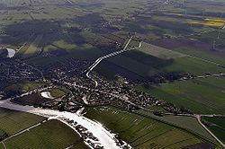
In the north of Wischhafen is the Elbe river. In the East is the South Elbe River. In the South of Wischhafen is the village Drochtersen. In the north are the two villages Freiburg and Oederquart.
Parts of the municipality
Wischhafen has the following parts:
Literature
References
Wischhafen Wikipedia(Text) CC BY-SA