
Official name Wirtz Dam Creates Lake LBJ Opened 1950 | Opening date 1951 Width (base) 80 feet (24 m) Height 36 m Length 1,674 m Construction began 1949 | |
 | ||
Operator Lower Colorado River Authority Similar Lake Lyndon B Johnson, Max Starcke Dam, Inks Dam, Colorado River, Lake Marble Falls | ||
Wirtz dam the slab bridges backroads dams
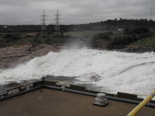
Wirtz Dam (formerly Granite Shoals Dam) was constructed from 1949 to 1951 to provide hydroelectric power and to form Lake Lyndon B. Johnson (formerly Lake Granite Shoals), one of the Texas Highland Lakes. Lake LBJ ‒ as it is more commonly referred to ‒ provides cooling water for the Lower Colorado River Authority's Thomas C. Ferguson Power Plant along Horsehoe Bay.
Contents
Map of Wirtz Dam, Texas, USA
Wirtz Dam was originally named Granite Shoals Dam until 1951 when it was renamed in honor of Alvin J. Wirtz who had been instrumental in the formation of the LCRA.
Likewise, Lake LBJ was originally named Lake Granite Shoals until 1965 when it was renamed for another advocate of the LCRA, U.S. President Lyndon B. Johnson.
Witz Dam and Lake LBJ are located due west of Lake Marble Falls and the city of Marble Falls, Texas.