
Population 1,238 (in 2011) Civil parish Winterbourne Dialling code 01980 | OS grid reference SU1734 Unitary authority | |
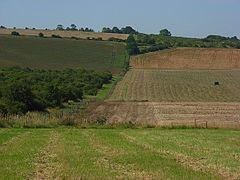 | ||
Winterbourne is a civil parish in southwest Wiltshire, England, about 3.5 miles (6 km) northeast of Salisbury. The parish encompasses the contiguous villages of Winterbourne Dauntsey, Winterbourne Earls and Winterbourne Gunner, together with the hamlet of Hurdcott south of Winterbourne Earls (not to be confused with Hurdcott Manor near Baverstock).
Contents
Map of Winterbourne, UK
The Port Way Roman road passes the villages on higher ground, on its route towards Old Sarum. The settlements are in the Bourne valley which also carries the A338 road and the West of England Main Line railway. Winterbourne was an earlier name for the river, which becomes dry in summer.
Local government
The civil parish elects a parish council. It is in the area of Wiltshire Council unitary authority, which is responsible for all significant local government functions.
The parish was created in 1934 by amalgamating the three ancient parishes of Winterbournes Earl, Dauntsey and Gunner.