
Type lake Primary outflows Winnipesaukee River Max. length 10.5 miles (16.9 km) Area 17.15 km² Shore length1 30 miles (48 km) | Primary inflows Basin countries United States Max. width 1.5 miles (2.4 km) Max depth 52 m | |
 | ||
Location Belknap County, New Hampshire Islands Mohawk Island, Pot Island, Three Islands, Hog Island, Loon Island Cities Laconia, Meredith, Tilton, Belmont, Sanbornton | ||
Winnisquam lake a favorite nh destination
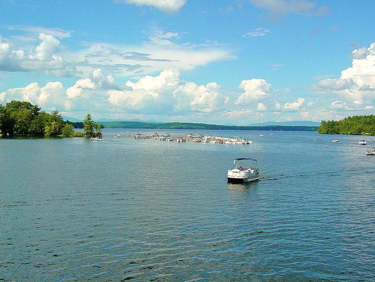
Winnisquam Lake is located in Belknap County in the Lakes Region of central New Hampshire, United States, in the communities of Meredith, Laconia, Sanbornton, Belmont, and Tilton. At 4,214 acres (1,705 ha), it is the fourth-largest lake located entirely in New Hampshire. The lake is primarily fed by the outlet from Lake Winnipesaukee, and Winnisquam's outlet is the Winnipesaukee River, flowing to the Merrimack River. The lake has a maximum depth of 170 feet (52 m).
Contents
Map of Lake Winnisquam, New Hampshire, USA
The lake is only a few miles from Interstate 93 via Exit 20 for U.S. Route 3 and New Hampshire Route 11. Winnisquam has two basins, a larger northern basin and a smaller southern one, with a bridge carrying Routes 3 and 11 separating them. The village of Winnisquam is located at the bridge.
The Abenaki people occupied the Winnisquam and Winnipesaukee area until colonists arrived in the mid-18th century. Winnisquam's surrounding county, Belknap, was founded in 1840 and named after Jeremy Belknap, a Congregational clergyman and prominent historian.
Winnisquam Lake is home to many species of fish. Cold water species include rainbow trout, lake trout, landlocked salmon, and whitefish. The warm water species include small- and largemouth bass, pickerel, horned pout, white perch, northern pike, walleye, black crappie, bluegill, and yellow perch. Remote lake and brook trout stocking is common when authorities find it necessary.