
Sector Southwest Elevation 686 m | Quadrant NW/SW Area 4.09 km² Population 2,136 (2012) Ward 9 | |
 | ||
Restaurants Pizza City Donair & Broast (H, Teriyaki Corner Japanese, Subway, The Chopped Leaf, Starbucks | ||
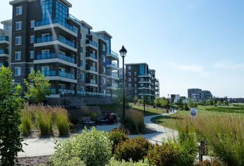
Liv in windermere edmonton a neighbourhood tour
Windermere is a neighbourhood in southwest Edmonton, Alberta, Canada, overlooking the North Saskatchewan River valley.
Contents
- Liv in windermere edmonton a neighbourhood tour
- Map of Windermere Edmonton AB Canada
- Demographics
- References
Map of Windermere, Edmonton, AB, Canada
It is bounded on the south by the future realignment of Ellerslie Road, on the east by 170 Street SW/Terwillegar Drive, on the northeast by Anthony Henday Drive, and on the west and northwest by the river valley.
According to the 2005 Municipal Census, there were 84 single-family dwellings in the neighbourhood, which was in an early stage of development at that time. The census also indicated that all but three of these homes were owner-occupied.
Windermere currently has two schools - St. John XXII, a separate K-9 Catholic School and Dr. Maragaret Ann Armour in the Ambleside community, a K-9 school that can accommodate up to 900 students.
Demographics
In the City of Edmonton's 2012 municipal census, Windermere had a population of 2,136 living in 1,498 dwellings, a 563.4% change from its 2009 population of 322. With a land area of 4.09 km2 (1.58 sq mi), it had a population density of 522.2 people/km2 in 2012.