
Topo map USGS Radial Mountain | Elevation 2,951 m | |
 | ||
Location | ||
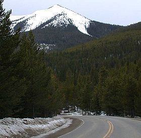
Willow Creek Pass, elevation 9,659 ft (2,944 m), is a mountain pass that crosses the Continental Divide in the Rocky Mountains of north central Colorado.
Contents
Map of Willow Creek Pass, Colorado 80473, USA
OverviewEdit
The pass encompasses the continental divide in the Rabbit Ears Range along the border between Jackson County (to the north) and Grand County (to the south). North of the pass, the Illinois River descends into North Park in the basin of the North Platte River. South of the pass, Willow Creek, for which the pass is named, descends southward to join the Colorado River near the town of Granby in Middle Park.
The pass is not an especially high one along the continental divide in Colorado, since the mountains separating North Park and Middle Park are relative low compared to nearby ranges. The approach from either side is mild and the pass is rarely closed in winter. The vicinity of the pass is sparsely populated, with no major communities in the vicinity. The pass is traversed by State Highway 125. The nearest commercial facilities are in the unincorporated community of Rand in Jackson County just north of the pass.