
Type Road Length 3.5 km | ||
 | ||
Route number(s) State Route 53 southbound (Brisbane Street to Riverside Drive) South end Riverside Drive (State Route 5), Perth | ||
Cbus building oz tour building 140 william street perth
William Street is a suburban distributor and one of two major cross-streets in the CBD of Perth, Western Australia. Commencing in western Mount Lawley it also crosses the Perth to Fremantle railway at the Horseshoe Bridge. It is a one-way street from Brisbane Street to Newcastle Street, from which point until its terminus at The Esplanade it has been progressively converted to two-way since 2008. Its route takes it through the Northbridge cafe and nightclub district as well as Perth's central business district. A ramp which took William Street traffic from The Esplanade onto the southbound Kwinana Freeway was closed in 2004 during the construction of the Esplanade railway station.
Contents
- Cbus building oz tour building 140 william street perth
- Map of William St Perth TAS 7300 Australia
- Route description
- Public transport
- Buildings
- Traffic direction
- References
Map of William St, Perth TAS 7300, Australia
Route description
William Street's northern end is at Walcott Street in Mount Lawley. It travels southwest along one block, for 130 metres (430 ft), before turning southwards. After 600 metres (2,000 ft) it reaches Vincent Street, and the southern edge of Mount Lawley. The road continues in a south-south-westerly direction, at the eastern edge of Hyde Park and the western edge of Highgate. One block beyond the park, within the suburb of Perth, William Street intersects Bulwer Street, which connects to three parallel arterial roads – Lord Street, Beaufort Street, and Fitzgerald Street – as well as the major north-south road, Charles Street.
William Street realigns itself one block further east through a 220-metre-long (720 ft) reverse curve. At this point, it intersects Brisbane Street, which bring southbound State Route 51 traffic to William Street. Prior to the restoration of two-way traffic on Beaufort Street, all southbound traffic was redirected via Brisbane Street to William Street. Beyond this intersection, the road is the southbound component of State Route 51. It continues in a straight line for 900 metres (3,000 ft) to Roe Street, and is at the eastern edge of Northbridge from Newcastle Street to that point.
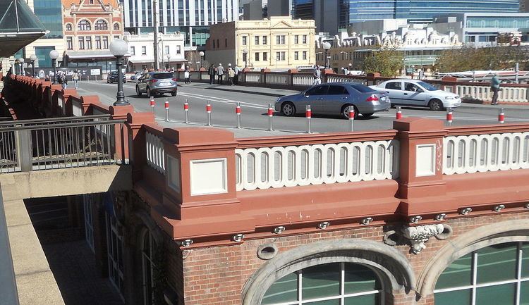
The Horseshoe Bridge takes the road over the Fremantle and Joondalup railway lines, passing between the Perth railway station and Wellington Street bus station. Beyond the bridge, the road continues in its south-south-westerly direction through the Perth CBD. It intersects all the major east-west routes. At the southern end of the bridge is Wellingtion Street. This is followed by Murray and Hay streets, which are pedestrian malls to the east; and then St Georges Terrace, which is a through-route for vehicular traffic. One more block takes it to an intersection with Mounts Bay Road, to the west, and the Esplanade to east. After one more block, alongside the Elizabeth Quay Bus Station and railway station, the road ends at Riverside Drive. This intersection also connects a Mitchell Freeway exit ramp and Kwinana Freeway southbound entrance ramp, components of the Narrows Interchange.
Public transport
William Street is serviced by buses running through Northbridge. Most of these services deviate via Elizabeth Quay Bus Station before going to their intended destination.
Buildings
There is an entrance to 108 St Georges Terrace (formerly the Bankwest Tower) on William Street. Wesley Church is also on the corner of William Street and Hay Street. Australia Place is further down William Street. There is a 24-hour McDonald's, as well as a KFC and Hungry Jack's. Both sides of William Street between Wellington Street and Hay Street have recently been redeveloped, Raine Square on the west and Gordon Stephenson House on the east side of the street. Although their addresses are on adjacent streets, 108 St Georges Terrace, the Gledden Building, the Palace Hotel and Walsh's Building are all on the corners along William Street.
In 2009 the East Perth Redevelopment Authority was involved in redeveloping six properties on the eastern side of William Street, between Roe and Newcastle Streets.
Traffic direction
William Street began as a two-way street, and during the era of trams in Perth, there were tramline along it. In the late 20th century and early 21st century, William Street was two-way north of Brisbane Street, and one-way southbound on the other side. In 2008, the section between The Esplanade and Wellington Street returned to two-way traffic. Further conversion occurred in 2010, with the Horseshoe Bridge was changed back to two-way traffic, and in 2013 the section between the bridge and Newcastle Street was converted.