
Airport type Public 1/19 5,007 1,526 Asphalt Elevation 152 m | Elevation AMSL 499 ft / 152 m 5,007 1,526 Aircraft operations 2,444 Phone +1 731-658-7556 | |
 | ||
Address Airport Rd, Bolivar, TN 38008, USA Similar Child Support Office, Hardeman County Chancery, Hardeman County General, Hardeman County Sheriff, Central High School | ||
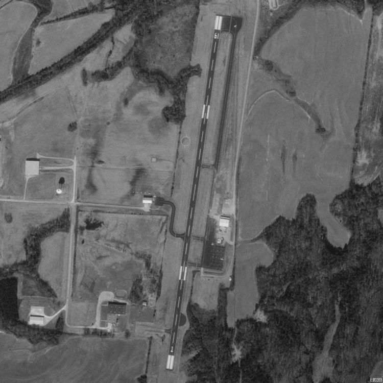
William L. Whitehurst Field (FAA LID: M08) is a county-owned, public-use airport located four nautical miles (7 km) southwest of the central business district of Bolivar, a city in Hardeman County, Tennessee, United States.
Facilities and aircraft
William L. Whitehurst Field covers an area of 85 acres (34 ha) at an elevation of 499 feet (152 m) above mean sea level. It has one runway designated 1/19 with a 5,005 by 75 ft (1,526 by 23 m) asphalt surface. For the 12-month period ending June 1, 2013, the airport had 2,444 aircraft operations, an average of 47 per week: 89% transient general aviation; 10% local general aviation; <1% military ref: faa
The airport is attended from 0830 to 1700 local time and has 100LL aviation fuel and Jet-A available, plus 93 mogas (for approved aircraft). It is included under the McKellar-Sipes Regional Airport FSS. It has medium intensity runway lighting and PAPI on both runways. NOTAMs are filed with McKellar-Sipes Regional Airport.