
Traversed by US 24 Topo map USGS Glentivar | Elevation 2,897 m | |
 | ||
Similar Rocky Mountains, Trout Creek Pass, Fremont Pass, South Park, Kenosha Pass | ||
.
Map of Wilkerson Pass, Colorado 80827, USA
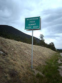
Wilkerson Pass, elevation 9,504 ft (2,897 m), is a mountain pass in the Rocky Mountains within Pike National Forest of Colorado and marks the eastern boundary of South Park (Park County, Colorado).
The pass is traversed by U.S. Highway 24 with a Forest Service visitor center at the summit along with a few short trails. The summit has a mild approach on both sides and does not cause problems for vehicles in winter, generally.
The pass is about 50 miles (80 km) west of Colorado Springs and is surrounded by peaks over 14,000 feet (4,300 m) with Pikes Peak of the Front Range to the east and the Collegiate Peaks of the Sawatch Range to the west.
References
Wilkerson Pass Wikipedia(Text) CC BY-SA