
Existed: 1936 – present Length 520.2 km | West end: I-70 / US 6 in Minturn Constructed 1926 | |
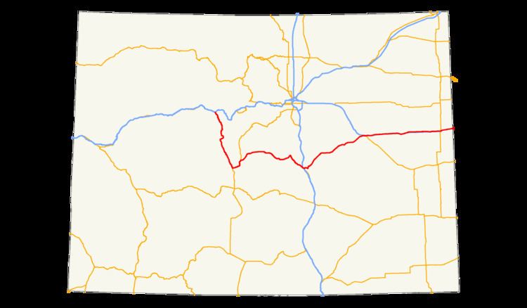 | ||
East end: I-70 / US-24 near Burlington | ||
U.S. Route 24 (US 24) is a major east–west route in the U.S. state of Colorado.
Route description
US 24 traverses the Rocky Mountains, starting near Minturn. It then continues east for about 30 miles to Leadville, where it turns south and goes to Buena Vista where it becomes concurrent with US 285. It continues with Highway 285 to the small community of Antero Junction. After that, it spends its time as a mountainous two-lane highway until it gets to the town of Divide, where it meets SH 67 and becomes a 4 lane highway. These highways overlap to Woodland Park. From there it passes through Crystola, Green Mountain Falls, and Cascade. Through Manitou Springs and Colorado Springs, where the road is known as Midland Expressway. Just east of Interstate 25, it is known as the Martin Luther King Jr Bypass. From Colorado Springs it continues northeast through several towns such as Falcon, Peyton, the city of Calhan, Ramah, Simla, and Matheson. When US 24 reaches Limon, it junctions with I-70/US 40/US 287/SH 71. It continues east (parallel to I-70) to Burlington where it joins I-70 to the Kansas state line.