
Country United States County Morton Area code 620 Elevation 1,045 m | Time zone CST (UTC-6) FIPS code 20-79125 Local time Sunday 5:52 PM | |
 | ||
Weather 16°C, Wind E at 8 km/h, 48% Humidity | ||
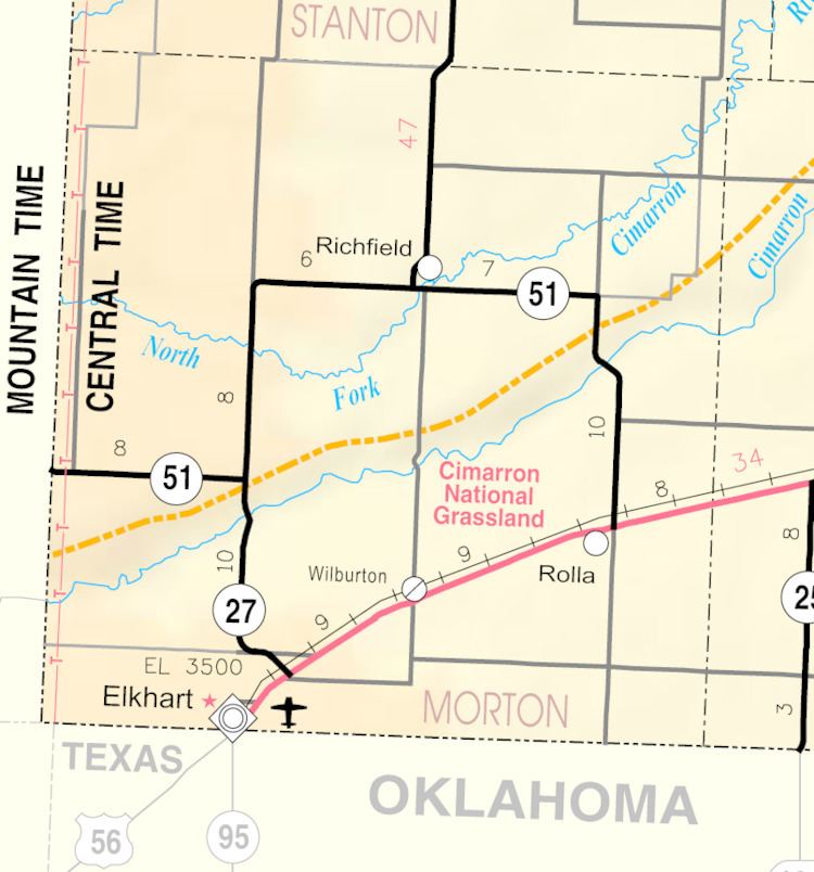
Wilburton is an unincorporated community in Morton County, Kansas, United States. Wilburton is located along U.S. Route 56 and the Cimarron Valley Railroad 9 miles (14 km) northeast of Elkhart.
Contents
Map of Wilburton, KS 67950, USA
Early history
For many millennia, the Great Plains of North America was inhabited by nomadic Native Americans. From the 16th century to 18th century, the Kingdom of France claimed ownership of large parts of North America. In 1762, after the French and Indian War, France secretly ceded New France to Spain, per the Treaty of Fontainebleau.
19th century
In 1802, Spain returned most of the land to France, but keeping title to about 7,500 square miles. In 1803, most of the land for modern day Kansas was acquired by the United States from France as part of the 828,000 square mile Louisiana Purchase for 2.83 cents per acre. In 1848, after the Mexican-American War, the Treaty of Guadalupe Hidalgo with Spain brought into the United States all or part of land for ten future states, including southwest Kansas.
In 1854, the Kansas Territory was organized, then in 1861 Kansas became the 34th U.S. state. In 1886, Morton County was established, which included the land for modern day Wilburton.
20th century
A post office was opened in Wilburton in 1913, and remained in operation until it was discontinued in 1957.
In the 1930s, the prosperity of the area was severely affected by its location within the Dust Bowl. This catastrophe intensified the economic impact of the Great Depression in the region.