
Basin size 515 km² Basin area 515 km² | Reference no. 4872 Length 30 km Country Germany | |
 | ||
Main source Source: NE of Altwarmbüchen, at confluence of Flöth and Edder56 m (Flöth 60 m above NN, Eder 59 m above NN) Progression Aller → Weser → North Sea | ||
The Wietze is a river, about 30 km long, and a tributary of the River Aller in Lower Saxony, Germany.
Contents
Map of Wietze, Germany
Geography
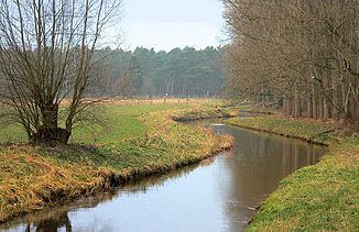
The river begins at the confluence of the Edder and Flöth northeast of Hanover near Altwarmbüchen. From there it flows several kilometres to the west through the southern part of Isernhagen to Langenhagen and from there on only in a northern direction to just beyond the village of Wietze, where it merges with the River Aller flowing from the south.
In the second half of its course the Wietze forms a pronounced depression with a bog-like region known as the Wietzenbruch. This is a region of extensive forest and fen woodland (Bruchwald) about 400 square kilometres (150 sq mi) in area. Wietzenbruch, a suburb of the town of Celle lies next to it.
The name of the river is derived from wizene ("wych elm river").