
Basin area 307 km² | Basin size 307 km² | |
 | ||
Main source confluence of the Hahnenbach and Mehlandsbach near Bellen33 m River mouth near Rotenburg into the Wümme18 m Similar Wümme, Hamme, Weesener Bach, Neetze, Großes und Weißes M | ||
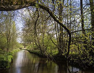
The Wiedau is a left-hand tributary of the Wümme in the north German state of Lower Saxony. The river begins near Bellen in the vicinity of Hemslingen in the district of Rotenburg (Wümme) at the confluence of the Hahnenbach and the Mehlandsbach, flows through the collective municipality of Bothel, a densely wooded and near natural depression, and discharges into the Wümme in Rotenburg shortly after being joined by the only slightly smaller Rodau.
Contents
Map of Wiedau, Germany
Water sport
The Wiedau is popular with anglers and canoeists. At high water, the Wiedau can be navigated from the road bridge in Bellen near Hemslingen to its mouth on the Wümme by small kayaks, a distance of 23 km.
References
Wiedau Wikipedia(Text) CC BY-SA