
Country United States GNIS feature ID 454057 Local time Sunday 7:48 AM | FIPS code 18-84068 Elevation 271 m Population 2,684 (2010) | |
 | ||
Weather 2°C, Wind E at 3 km/h, 96% Humidity Area 91.19 km² (90.6 km² Land / 60 ha Water) | ||
Whitewater Township is one of thirteen townships in Franklin County, Indiana. As of the 2010 census, its population was 2,684.
Contents
- Map of Whitewater Township IN USA
- History
- Geography
- Unincorporated towns
- Major highways
- Cemeteries
- References
Map of Whitewater Township, IN, USA
History
Whitewater Township was created in 1816.
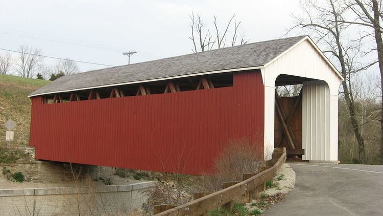
The Snow Hill Covered Bridge and Salmon Turrell Farmstead are listed on the National Register of Historic Places.
Geography
According to the 2010 census, the township has a total area of 35.21 square miles (91.2 km2), of which 34.98 square miles (90.6 km2) (or 99.35%) is land and 0.23 square miles (0.60 km2) (or 0.65%) is water.
Unincorporated towns
(This list is based on USGS data and may include former settlements.)
Major highways
Cemeteries
The township contains two cemeteries: Otwell and Snow.
References
Whitewater Township, Franklin County, Indiana Wikipedia(Text) CC BY-SA