
Topo map USGS Whitetop Mountain Easiest route Hike Prominence 317 m | Elevation 1,682 m | |
 | ||
Similar Mount Rogers, Beartown Mountain, Mount Mitchell, Roan Mountain, High Knob | ||
Whitetop mountain band sally anne
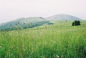
Whitetop Mountain is the second highest mountain in the U.S. state of Virginia, after nearby Mount Rogers. It is located at the juncture of Grayson, Smyth, and Washington Counties in the Commonwealth of Virginia. Whitetop was the location of the White Top Folk Festival from 1932 to 1939, with the exception of 1937. The mountain is also unique for the fact that it represents an ecological "island" of flora and fauna commonly found much further north than Virginia, such as old growth red spruce and other northern softwoods.
Contents
- Whitetop mountain band sally anne
- Map of Whitetop Mountain Wilson Creek VA 24292 USA
- Whitetop mountain virginia s second highest peak
- References
Map of Whitetop Mountain, Wilson Creek, VA 24292, USA
Whitetop mountain virginia s second highest peak
References
Whitetop Mountain Wikipedia(Text) CC BY-SA