
- summer (DST) EDT (UTC-4) Local time Sunday 7:14 AM | Population 16,702 (2000) | |
 | ||
- water 0.1 sq mi (0 km), 0.68% Weather 3°C, Wind N at 5 km/h, 80% Humidity Points of interest Hope Lodge, Fort Washington State Park, Miles Park, Wissahickon Creek, Highlands Historical Society | ||
Whitemarsh Township is a Home Rule Municipality in Montgomery County, Pennsylvania, USA. However, it maintains its former classification of "Township" in its official name. The population was 17,349 at the 2010 census.
Contents
- Map of Whitemarsh Township PA USA
- History
- National Register of Historic Places
- Geography
- Demographics
- Government
- Recreation
- Education
- Roadways
- Rail
- Aviation
- References
Map of Whitemarsh Township, PA, USA
History
Whitemarsh was originally inhabited by the Lenni Lenape tribe of Native Americans. It was first settled by European colonists in 1683, as part of a tract of land purchased from William Penn by Major Jasper Farmar. Though Major Jasper Farmer died before making the voyage to his new land, his widow and family sailed, with servants, to Philadelphia in 1685. They established their homestead in Fort Washington. After the Widow Farmer died sometime in the 1690s, her son Edward began to sell 100 to 200 acre pieces of the township to Quakers and German immigrants.
In 1686, the discovery of limestone in Oreland in nearby Springfield and Upper Dublin townships, and subsequent discoveries of limestone in the township itself, drew settlers to Whitemarsh Whitemarsh Township was incorporated in 1704 as part of Philadelphia County and was one of the 28 original communities that comprised Montgomery County when it was created in 1784. The area in the 1600s and 1700s consisted of large English estates and its famous limestone quarries.
During the American Revolutionary War, both the Battle of White Marsh and the Battle of Barren Hill took place within the township.
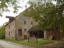
National Register of Historic Places
Geography
According to the United States Census Bureau, the township has a total area of 14.7 square miles (38.1 km2), of which, 14.6 square miles (37.8 km2) of it is land and 0.1 square miles (0.3 km2) of it (0.68%) is water.
Adjacent to the Andorra section of Philadelphia, Whitemarsh is bordered in Montgomery County by Springfield, Upper Dublin, Whitpain, and Plymouth Townships and Conshohocken Borough. It is also bordered by the Schuylkill River, which separates it from Lower Merion Township.
Demographics
As of the 2010 census, Whitemarsh Township was 90.7% White, 3.5% Black or African American, 0.1% Native American, 4.2% Asian, and 1.2% were two or more races. 1.7% of the population were of Hispanic or Latino ancestry [3].
As of the census of 2000, there were 16,702 people, 6,179 households, and 4,597 families residing in the township. The population density was 1,143.5 people per square mile (441.4/km2). There were 6,372 housing units at an average density of 436.3 per square mile (168.4/km2). The racial makeup of the township was 93.29% White, 2.21% African American, 0.02% Native American, 3.70% Asian, 0.14% from other races, and 0.63% from two or more races. Hispanics or Latinos of any race were 0.99% of the population.
There were 6,179 households, out of which 34.4% had children under the age of 18 living with them, 64.4% were married couples living together, 7.1% had a female householder with no husband present, and 25.6% were non-families. 20.8% of all households were made up of individuals, and 7.3% had someone living alone who was 65 years of age or older. The average household size was 2.62 and the average family size was 3.06.
The age distribution was 24.3% under the age of 18, 5.0% from 18 to 24, 29.8% from 25 to 44, 25.1% from 45 to 64, and 15.7% who were 65 years of age or older. The median age was 40 years. For every 100 females there were 93.7 males. For every 100 females age 18 and over, there were 89.6 males.
The median income for a household in the township was $78,630, and the median income for a family was $91,731. Males had a median income of $58,774 versus $41,977 for females. The per capita income for the township was $39,785. About 1.6% of families and 2.9% of the population were below the poverty line, including 1.8% of those under age 18 and 3.1% of those age 65 or over.
Government
Whitemarsh Township is governed by a five-member Board of Supervisors elected to four-year terms. The current Board has four Democrats and one Republican. The Chairperson is Sara Erlbaum (D), and the Vice-Chairperson is Amy Grossman (D). The other three members are Robert R. Hart (D), Cathy Peduzzi (D) and James A. Totten (R).
Recreation
The Fort Washington State Park is a 483-acre (1.95 km2) site located in the middle of the township, along the Wissahickon Creek. Miles Park Which is located on Germantown Pike at the intersection of Joshua Road includes basketball courts, baseball fields and a walking track. It also has a snack bar and has vending machines. The Philadelphia Cricket Club has two golf courses in Whitemarsh Township.
Education
The Colonial School District provides public education to the children of Whitemarsh Township.
Roadways
The Pennsylvania Turnpike (Interstate 276) and the Fort Washington Expressway (Pennsylvania Route 309) run through the township. Although neither have an interchange in Whitemarsh, the turnpike has an interchange in nearby Plymouth Township, and the Route 309 expressway also has an interchange in Fort Washington which also connects with the turnpike. Arterial roads in the township include Ridge, Germantown, Butler, Skippack, and Bethlehem Pikes, Stenton and Pennsylvania Avenues, and Joshua and Morris Roads.
Rail
The most prominent of these are the Lansdale/Doylestown and Manayunk/Norristown Southeastern Pennsylvania Transportation Authority (SEPTA) rail lines, both of which have stations in the township. The Lansdale/Doylestown Line, which connects Bucks, Montgomery, and Philadelphia Counties has a station in the Fort Washington section of the township. The Manayunk/Norristown Line, which runs along the Schuylkill River, has two stations located in Miquon and Spring Mill.
Aviation
There are no airports in Whitemarsh Township. The closest airport is the Wings Field.