
Local time Sunday 4:09 AM | ||
 | ||
Weather 18°C, Wind NE at 6 km/h, 90% Humidity | ||
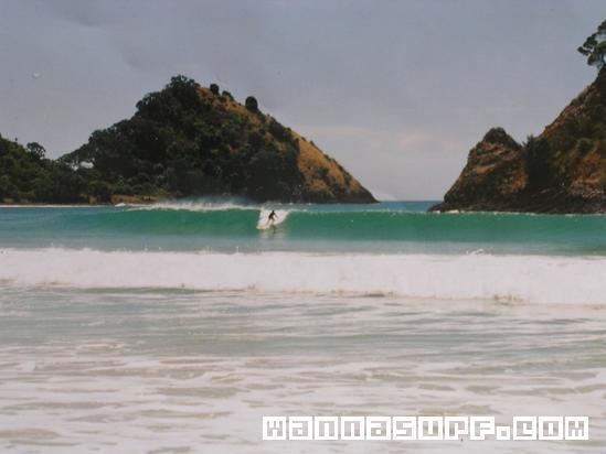
Whangapoua is a small settlement of mostly holiday houses on the Coromandel Peninsula of New Zealand. It is situated 25 minutes drive east over the Coromandel Range from Coromandel along the northeastern coastline encompassing popular white sand beaches New Chums Beach, Matarangi, Kuaotunu Beach and Otama Beach.
Map of Whangapoua 3582, New Zealand
Amenities in Whangapoua include a small wharf and boat ramp, and a general store that also supplies petrol and diesel. The nearby estuary provides further water access for boats. Whangapoua Beach is a safe 1.5 km long sandy swimming beach flanked in the north by the rocky foreshore towards Motuto Point and by Te Rehutae Point in the southeast. The northern end of Whangapoua Beach is the starting point of a partly unformed track to New Chums Beach - that beach is only accessible via this track or by boat. The nearest school is in Te Rerenga.
Whangapoua's Māori history dates back to the 13th century. A reserve at Opera Point, east of Whangapoua, contains the remains of the Raukawa pa site. European settlers started arriving in the 1860s, drawn to the area chiefly for kauri milling and gold mining. Today, Whangapoua is spread along behind the beach and consists of about 120 permanent residents, but can swell to over 1000 with holiday residents during the most popular holiday period from late December to February.