
Surface area 20.6 sq mi (53 km²) Area 53.35 km² | Basin countries United States Surface elevation 46 m | |
 | ||
Similar | ||
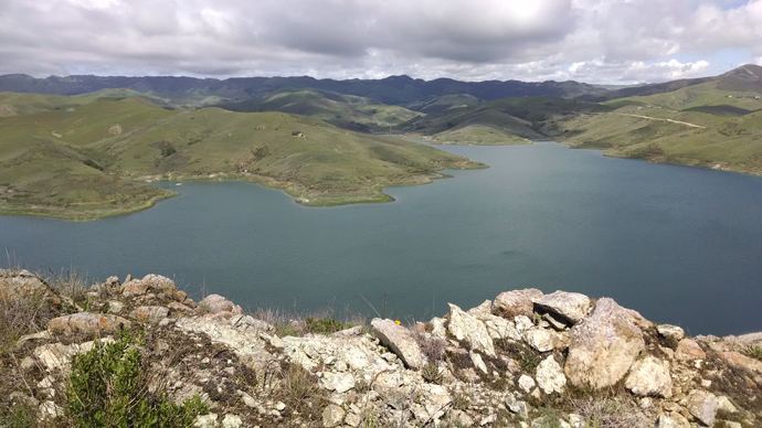
Whale Rock Reservoir is a reservoir near Cayucos in San Luis Obispo County, California.
Map of Whale Rock Reservoir, California 93430, USA
The reservoir was formed by the building of Whale Rock Dam on Old Creek by the Whale Rock Commission. It is a 193-foot (59 m) tall earthfill dam that was completed in 1961. The reservoir has a capacity of 40,662 acre feet (50,156,000 m3). The watershed has an area of 20.6 square miles (53 km²). It provides drinking water for the city of San Luis Obispo, the California Men's Colony, Cal Poly, and the Cayucos Area Water Organization. The water is brought to San Luis Obispo by the 17.6 mile (28 km) long, 30-inch (760 mm) diameter Whale Rock Conduit. There is an 800 kW hydroelectric plant at the end of the pipeline near Cal Poly.
References
Whale Rock Reservoir Wikipedia(Text) CC BY-SA