 | ||
The boys from the austalian trout foundation flyfish the whakapapa river with troutbeck fishing lodg
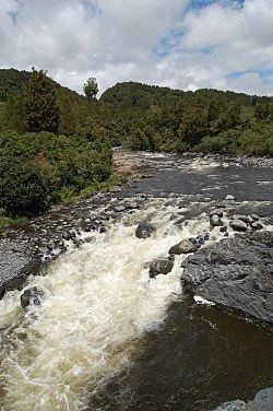
The Whakapapa River in New Zealand trickles off the Whakapapa skifield of Mount Ruapehu, down the western slopes of the mountain through Owhango before finally merging with the Whanganui River just east of Kakahi at 38°55.92′S 175°24.5′E.
Contents
- The boys from the austalian trout foundation flyfish the whakapapa river with troutbeck fishing lodg
- Map of Whakapapa River Manawatu Wanganui New Zealand
- Bridge over the whakapapa river near owhango nz flv
- References
Map of Whakapapa River, Manawatu-Wanganui, New Zealand
Peter McIntyre had a home overlooking the confluence of the Whanganui and Whakapapa rivers, and painted several oil landscapes of the Whakapapa River. Ironically after his death the Whakapapa River undermined the white pumice cliffs where his house was built and claimed the house as its own.
Occasionally people kayak a 25-kilometre (16 mi) from near Owhango (38°59.80′S 175°23.92′E) to near Kakahi (38°56.41′S 175°24.50′E).
Bridge over the whakapapa river near owhango nz flv
References
Whakapapa River Wikipedia(Text) CC BY-SA
