
Grid reference SP862096 Location map Magic Map Notification 1986 | Interest Biological Area 19 ha | |
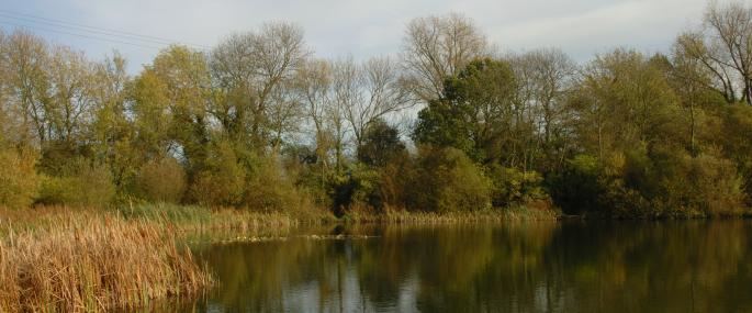 | ||
Weston Turville Reservoir is a 19 hectare biological Site of Special Scientific Interest south of Weston Turville in Buckinghamshire. It is owned by the Canal & River Trust, and the open water is leased to sailing and fishing clubs while the surrounding land is managed by the Berkshire, Buckinghamshire and Oxfordshire Wildlife Trust. The site is in the Chilterns Area of Outstanding Natural Beauty.
Contents
- Map of Weston Turville Reservoir Weston Turville Aylesbury UK
- Weston turville reservoir cloud time lapse
- References
Map of Weston Turville Reservoir, Weston Turville, Aylesbury, UK
The reservoir was built in 1797 to supply water to the Wendover Arm of the Grand Union Canal. Large areas now have a deep silt deposit, but the open water is an important site for 46 species of over-wintering waterfowl, and it is nationally important for shovelers. The areas around the reservoir have tall fen, reed beds and willow carr, declining habitats in Britain. There are over 300 species of beetle, of which six are rare nationally.
There is access to the perimeter path around the reservoir from World's End Lane and Halton Lane.