
Country United States Incorporated 1717 Local time Saturday 1:24 AM Population 18,272 (2010) | State Massachusetts Settled 1675 Elevation 300 ft (91 m) Zip code 01581 | |
 | ||
Weather 1°C, Wind NE at 19 km/h, 92% Humidity Points of interest Lake Chauncy Beach, Westborough Historical Society, Wayne F. McCallum Wildlife Park, Cedar Swamp | ||
Best towns for families westborough massachusetts
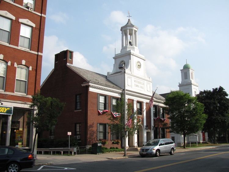
Westborough is a town in Worcester County, Massachusetts, United States. The population was 18,272 at the 2010 Census, in nearly 6,900 households. Incorporated in 1717, the town is governed under the New England open town meeting system, headed by a five-member elected Board of Selectmen whose duties include licensing, appointing various administrative positions, and calling a town meeting of citizens annually or whenever the need arises.
Contents
- Best towns for families westborough massachusetts
- Map of Westborough MA USA
- History
- Registered Historic Places
- Geography
- Adjacent towns
- Demographics
- Education
- Transportation
- Government and infrastructure
- Media
- Library
- Sites of interest
- Accolades
- Annual events
- Places of worship
- Notable people
- References
Map of Westborough, MA, USA
History
Before recorded time, the area now known as Westborough was a well-travelled crossroads. As early as 7,000 BC, prehistoric people in dugout canoes followed the Sudbury and Assabet Rivers to their headwaters in search of quartzite for tools and weapons.
From 1200 to 1600 AD, seasonal migrations brought Nipmuc Indians to hunt and fish near Cedar Swamp and Lake Hoccomocco. Using Fay Mountain as a landmark, Indians crisscrossed Westborough on well-worn paths: the old Connecticut Path leading west from Massachusetts Bay; the Narragansett Trail leading south, and the trail (along the present Milk Street) leading to Canada.
The early English explorer John Oldham followed these trails through Westborough in 1633, and settlers in search of fertile farmlands followed not long after. By late 1675, a few families had settled near Lake Chauncy, in the "west borough" of Marlborough.
On November 18, 1717, Westborough was incorporated as the hundredth town in Massachusetts, populated by twenty-seven families, including Thomas Rice who had represented Marlborough in the Great and General Court. Soon large farms were carved out, mills built along the Assabet River and Jackstraw Brook, and taverns flourished. Westborough's first minister, Reverend Ebenezer Parkman, shepherded the growing town of colonists through the years toward independence from Great Britain. Forty-six minutemen from Westborough fought under Captain Edmund Brigham in the Revolutionary War.
In 1775, Northborough split off as the "north borough" of Westborough, much as Westborough split off from Marlborough some 58 years before. However, the two towns shared a meetinghouse for some time more.
In 1810 the route from Boston to Worcester was straightened and improved into an official turnpike (the present Route 9), and along its Westborough route, the Wesson Tavern Common, Forbush Tavern and Nathan Fisher's store prospered. The center of commerce shifted downtown in 1824 with the arrival of the steam train through Westborough's center. The railroad brought a new era to the town industry: over the next century, local factories shipped boots and shoes, straw hats, sleighs, textiles, bicycles, and eventually abrasive products, across the nation. Westborough dairies supplied cities with milk and local greenhouses shipped out carnations, while the eight orchards found ready markets for their produce.
In 1848 the State Reform School for Boys, the first publicly funded reform school in the United States, was opened on Lake Chauncy. It operated as a State reform school until 1884 at which time the newly established Westborough State Hospital took over the property. In the same year, the reform school was relocated nearby on Chauncy Street and renamed The Lyman School for Boys.
The industrial progress of the entire country is indebted to Westborough's most famous native son Eli Whitney Jr. Born in 1765, Whitney invented the cotton gin in 1795 after graduating from Yale, In 1798 he introduced mass production to the United States at his Whitney Arms Company in New Haven, Connecticut. Whitney's legacy is apparent in the modern industries located within the town's borders: AstraZeneca, Dover Electric, Proteon, Genzyme, EMC Corporation, IBM, PFPC, Bose Corporation and the global headquarters of American Superconductor.
Registered Historic Places
Westborough is home to several listings on the National Register of Historic Places:
Geography
According to the United States Census Bureau, the town has a total area of 21.6 square miles (56.0 km2), of which 20.5 square miles (53.1 km2) of it is land, and 1.1 square miles (2.8 km2) of it is water or 5.09 percent. Westborough is drained by the Sudbury and Assabet rivers. The town contains numerous bodies of water, including Lake Chauncy, Mill Pond, Lake Hoccomocco, and the Westborough Reservoir. Lake Chauncy is open to swimming, boating, and fishing, and has a public beach open to residents of Westborough and Northborough during the summer months. The average elevation of the town is approximately 300 feet (91 m).
Adjacent towns
Westborough is located in east/central Massachusetts, located about 28 miles (45.47 km) west of Boston and 12 miles (19 km) east of Worcester. It is bordered by six towns.
Demographics
Data from the U.S. Census of 2010 shows there were 18,272 people, 6,924 households, and 4,763 families residing in the town (official). The population density was 891.3 people per square mile (unofficial). The latest 2010–2014 American Community Survey (ACS) estimated the town's total population slightly higher, at 18,481, residing in 7,551 households. According to the latest ACS estimate, the racial makeup of the town was 73.8% White, 2.9% Black or African American, 0.3% Native American, 18.3% Asian, 0% Pacific Islander, 1.3% from other races, 3.4% from two or more races, Hispanic or Latino of any race were 6.5% of the population. Westborough has a significant Indian-American Community making up 11.5% of the population, as well as boasting a strong immigrant community with nearly 4,000 residents of non-U.S. origins (21.3%).
According to ACS estimates, there are 4,789 family households out of which 34.8% had children under the age of 18 living with them, 59.3% were married couples living together, 7.2% had a female householder with no husband present, and 32.4% were non-families. Of all households 22.8% were made up of individuals 65 years of age or older. The average household size was 2.54 and the average family size was 3.18.
In addition, the town the population was spread out with 11.5% under the age of 10, 14.3% from 10 to 19, 10.7% from 20 to 29, 11.2% from 30 to 39, 18% from 40 to 49, 16.1% from 50 to 59, 8.6% from 60 to 69, 4.8% from 70 to 79, and 4.9% who were 80 years of age or older. The median age was 42 years. For every 100 females, there were 94.3 males.
The median income for a household in the town (based on U.S. Census ACS five-year estimate) was $105,552, and the median income for a family was $127,623. The per capita income for the town was $45,760. Of the population 4.4% was below the poverty line, including 5.0% of those under age 18 and 3.1% of those age 65 or over. The labor force numbered 10,180 with an unemployment rate in the town of 3.3%. Of the population over age 25, 94.6% graduated high school (or equivalent) and 60.4% hold a bachelor's degree or higher.
Education
Westborough Public Schools consist of three elementary schools, two middle schools and one high school:
The Mill Pond School is the newest school addition to Westborough. The Mill Pond School consists of grade 4 to 6, then Gibbons Middle School which consists of grades 7 and 8, and then Westborough High School. There are three options depending upon residents' geographic location in the town for preschool through third grade.
Transportation
The Town of Westborough is located on the west side of the Massachusetts Turnpike (Interstate 90) and Interstate 495 intersection. Route 30 (Main Street) and Route 135 (South Street/Milk Street) intersect in a rotary at the town's center, while Route 9 runs nearby serving much of the town's commerce.
In terms of public transportation, Westborough is currently served by an MBTA commuter rail station on the Framingham/Worcester Line as well as public bus service through the Worcester Regional Transit Authority.Limited commercial airline service is available at the Worcester Regional Airport.The nearest international airport is at Boston.
Government and infrastructure
The Robert F. Kennedy Children's Action Corps, Inc. operates two juvenile correctional facilities in Westborough on behalf of the Massachusetts Department of Youth Services:
Media
Newspapers:
Broadcast:
Cablecast (Public, educational, and government access (PEG) cable tv channels):
Library
The Westborough Public Library began in 1857. In fiscal year 2008, the town of Westborough spent 1.24% ($846,826) of its budget on its public library—some $45 per person.