
OS grid reference SK851448 Post town NEWARK Local time Saturday 6:24 AM | Sovereign state United Kingdom Postcode district NG23 | |
 | ||
Weather 7°C, Wind SE at 14 km/h, 89% Humidity UK parliament constituency Sleaford and North Hykeham | ||
Westborough is a village in the South Kesteven district of Lincolnshire, England. It is situated 1 mile (1.6 km) east from the A1 road and Long Bennington, and 6 miles (10 km) north from Grantham. The village is part of the civil parish of Westborough and Dry Doddington .
Map of Westborough, Newark, UK
Nearby to the north is Dry Doddington. The Viking Way and River Witham pass through the village.
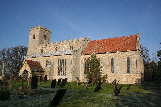
The village Grade I listed Anglican church is dedicated to All Saints.
References
Westborough, Lincolnshire Wikipedia(Text) CC BY-SA