
Population 5,151 (2011 census) Area 3.58 km² | Postcode(s) 2073 Postal code 2073 | |
 | ||
Location 18 km (11 mi) north-west of Sydney CBD | ||
West Pymble is a suburb on the Upper North Shore of Sydney in the state of New South Wales, Australia 18 kilometres (11 mi) north-west of the Sydney Central Business District in the local government area of Ku-ring-gai Council. Pymble is a separate suburb to the east, sharing the postcode of 2073.
Contents
- Map of West Pymble NSW 2073 Australia
- History
- Commercial area
- Transport
- Parks
- Schools
- Places of worship
- Community groups and organised activities
- Sporting facilities
- Demographics
- Notable residents
- References
Map of West Pymble NSW 2073, Australia
History
The land on which West Pymble was built was Guringai country, until European arrival brought disease which greatly reduced the population. By 1824, Aboriginal people in the area had been reduced to 'the remains of an Aboriginal tribe', who periodically walked through the area on their way from Bobbin Head to Pymble Hill. Early European settler Robert Pymble told his grandchildren that the Aboriginal people had gone by 1856.
Logging was the first industry of the area, with both government logging camps and private contractors felling the biggest trees and dragging them to the Lane Cove River or local sawpits. The Lofberg family, who were established in the area by the 1860s, shipped lumber to the Sydney markets on their boats, and raised nine children on their farm in West Pymble.
The rugged country and sloping land of West Pymble was slower to be settled than surrounding flatter areas, and became a bush haven for absconded convicts, illicit stills, gambling and cockfighting.
As the timber was felled, land was used for orchards, and by the 1880s growing citrus, apples, pears and stone fruit was a major industry. The Lofberg, Kendall and Munday families grew fruit and raised pigs on their mixed farms. These enterprises survived into the 1920s, although the arrival of codling moth decreased fruit growing, and the construction of the North Shore railway line in the 1890s made the land more valuable as residential property. Pymble soon boasted Hamilton Bros Universal Providers, near the station and other businesses. The Lofbergs diversified into quarrying, with their sandstone quarry being taken over by the Ku-ring-gai Council in 1926, to provide materials for roads and footpaths in the municipality.
West Pymble was subdivided between 1900 and 1915, but was still sparsely populated because of its distance from the railway at Pymble. Much of the area remained semi-rural throughout the interwar period.
Much of the area was developed after the Second World War (mainly in the 1950s and 1960s) with defence personnel housing and homes for returning soldiers built in brand new streets pushed through the bush. West Pymble's war memorial hall was opened in 1962 on the Lofbergs' original landholding on Lofberg Road. The original housing style included three-bedroom weatherboard cottages. Many remain but a lot of them have been significantly extended and/or upgraded since; others have been demolished and replaced with larger homes.
West Gordon Public School opened in 1951, and later West Pymble Public School in 1960 to educate the children of the new residents, and the inhabitants of the Bernard Smith Children's home, run by the Central Methodist Mission from 1960 to 1988.
The section of West Pymble, on the eastern side of Ryde Road, including Kiparra St, Dunoon Crescent, Wyuna Avenue and adjoining streets, was originally designated "West Gordon" and it was considered to be part of the suburb of Gordon. However, in 1990, the suburban boundaries were reviewed and this neighbourhood became re-designated as part of West Pymble instead, although the name of the public primary school did not change.
Pymble West Post Office opened on 1 December 1958 and closed in 1974.
Commercial area
The Philip Mall, located on Kendall Street, is a street mall with two rows of shops facing each other. Philip Mall includes an IGA supermarket, hairdresser, beauty salon, takeaway, greengrocer, bread shop, newsagent, cafe & deli, a cafe, Chinese restaurant, butcher, pizza shop, pharmacy, chocolate shop, bottle shop, Westpac ATM, physiotherapist, dentist and a veterinary clinic. Nearby is a BP petrol station.
Philip Mall was redeveloped in the 1990s. The development included the removal of gardens between two shops which had become largely dilapidated. Some of the gardens were replanted with the rest of the area paved, which significantly increased space in the mall. Seating and additional bicycle stands were installed. At the same time the large children's playground was upgraded with improved safety features and playsets.
In 1998 the Boonah Creative Arts Centre was established in the old community centre, operated by the Sisters of Mercy. The Boonah Centre provides fine arts education to mentally disabled persons.
In 2012, Philip Mall was re-landscaped, with the centre area between the shops being gutted, and a new layout built to give more space to allow shoppers to move between the 2 lines of shops.
The Philip Mall shops association is the West Pymble Chamber of Commerce which organises many events of interest to and including the local community.
The Gordon West Shops are in Duneba Avenue, West Pymble. They include a dentist, hair salon, German and Italian restaurants. The Gordon West shops are a significantly smaller group than Philip Mall shops.
Transport
The closest railway station is Pymble railway station located about 2.5 kilometres (1.6 mi) from the centre of West Pymble as well as Macquarie Park railway station and Macquarie University Railway Station located North of Macquarie Park, both located on Sydney Train's Northern Line services again about 2.5 km from the centre. Although Pymble Station is closest, it is difficult to access from West Pymble, and bus services such as Transdev NSW's Route 560 run from West Pymble to Gordon railway station. Transdev also runs a bus service, route 575, from Macquarie University to Hornsby railway station via Turramurra High School and West Pymble. In addition, Forest Coach Lines' Route 197 runs along Ryde Road through West Pymble from Macquarie University to Gordon Station, then onwards to Mona Vale via St Ives.
At the 2011 census, 18% of employed people travelled to work on public transport compared to the national average of 10%, and 61% by car (either as driver or as passenger).
Parks
West Pymble is surrounded by Lane Cove National Park and provides excellent bushwalking opportunities.
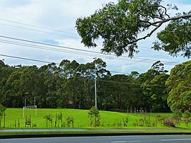
The Bicentennial Park oval complex in Lofberg Road consists of netball courts, soccer and cricket fields, a public swimming pool, a children's playground and barbecue facilities. The park was originally a quarry and later a bike track until it was regenerated in 1988 to coincide with the Australian Bicentenary.
Other parks in the area include:
Schools
Places of worship
Community groups and organised activities
Sporting facilities
Demographics
At the 2011 census, the suburb of West Pymble recorded a population of 5,151. Of these: