
Country United States First settled 1838 Founded by Josiah Howell Population 12,268 (2013) | County Howell Incorporated (city) 1883 Zip code 65775 Local time Friday 9:27 PM | |
 | ||
Named for Location on a prairie west of the nearest town Weather 10°C, Wind N at 11 km/h, 80% Humidity | ||
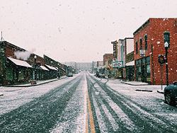
South of west plains missouri on highway 63
West Plains is a city in Howell County, Missouri, United States. The population was 11,986 at the 2010 Census. It is the county seat of Howell County.
Contents
- South of west plains missouri on highway 63
- Map of West Plains MO 65775 USA
- History
- The American Civil War
- The Great Depression era
- West Plains Dance Hall Explosion
- After the Depression
- Geography
- Climate
- Demographics
- 2010 census
- 2000 census
- Neighborhoods
- Government
- Public schools
- Private education
- Higher education
- Transportation
- Airport
- Attractions
- Parks
- Media
- Newspaper
- Radio
- Television
- Notable people
- References
Map of West Plains, MO 65775, USA
History
The history of West Plains can be traced back to 1832, when settler Josiah Howell (after whom Howell County is named) created the first settlement in the region known as Howell Valley. West Plains was so named because the settlement was on a prairie in a westerly direction from the nearest town, Thomasville.
The Courthouse Square Historic District, Elledge Arcade Buildings, International Shoe Company Building, Mount Zion Lodge Masonic Temple, W. J. and Ed Smith Building, and West Plains Bank Building are listed on the National Register of Historic Places.
The American Civil War
The location of West Plains led to nearly constant conflict due to the proximity to what was then the border between the Union and Confederacy. West Plains was largely burned to the ground, and Howell County as a whole was devastated. No major battles occurred in West Plains or Howell County, but much of the devastation came from constant guerrilla warfare.
Confederate Brigadier General James Haggin McBride gave residents an ultimatum to either join the Confederate army or to flee the area. An overwhelming majority of Howell County residents chose to flee, and over 90% of the population had fled by the time the war was over. Many, however, also chose to fight for the Confederacy, as McBride promised to protect his soldiers' property and loved ones. Men who spoke out against the Confederacy were arrested, as martial law had been declared by McBride. Though Howell County was in Union-controlled Missouri, it was easily within Confederate control due to its position on the Arkansas border.
The Great Depression era
As was the case with many other locations, the Great Depression hit West Plains in the 1930s. Citizens had little knowledge of what was going on with the national scene, except for what Neathery says in his book, "every place was a boom town, [but] in some places things were going bust as well." The first bank to fail in West Plains was the Farmers Savings Bank in West Plains circa 1926, and the lack of the present-day Federal Deposit Insurance Company meant that some people initially lost whatever wealth was deposited.
West Plains Dance Hall Explosion
On April 13, 1928, for reasons still unknown, a violent explosion occurred in downtown West Plains. About 60 people had gathered in the Bond Dance Hall, which was on the second floor of a building on East Main Street. The explosion was reported to be felt for miles, even in Pomona, which is approximately ten miles from West Plains. Windows were shattered throughout the block, and cars were also warped on the street. The explosion also damaged the nearby Howell County Courthouse so badly that it was vacated and left until late 1933, when it was demolished by the Civil Works Administration. 37 people were killed in the explosion, and 22 people were injured. 20 of those killed were never positively identified and buried in a mass grave at Oak Lawn Cemetery in the southeast part of town. Today, they are memorialized by the Rock of Ages monument, erected on October 6, 1929. The explosion has also been remembered in a folk song recorded 30 years later.
The cause of the explosion is still a topic of controversy nearly a century after the blast. Numerous causes for the explosion have been offered, but a definitive story has never been proven to be true. The most widely accepted theory is that the explosion somehow originated from leaking gasoline in a garage owned by J. W. Wiser, which happened to be on the floor below. Because Wiser was at the garage at the time, some have speculated that the blast was intentionally caused by Wiser as a suicide attempt, which his wife reportedly refused to acknowledge. In addition, the late West Plains native Robert Neathery explained in his 1994 book, West Plains As I Knew It, that a truck containing dynamite parked in the garage may have been the cause, indirectly part of a crime in which someone shot Wiser and set a fire to cover up the crime, and the dynamite exploded.
The event is fictionalized in the short novel The Maid's Version by Daniel Woodrell, which is about a similar dance hall explosion in the fictional town of West Table.
After the Depression
On Friday evening, April 2, 1982, a long-track F4 tornado struck the West Plains area, beginning in Ozark County and ending near what was the airport at the time. Many homes and businesses were significantly damaged or leveled by the tornado, which killed 3 and injured at least 28 as it hit the West Plains Country Club and nearby homes, as well as businesses located on U.S. Route 63.
The downtown area of West Plains, namely Court Square, was listed on the National Register of Historic Places on July 17, 2003. The Downtown Revitalization Economic Assistance for Missouri (DREAM) Act also opened up funding for renovations and improvements for certain downtown buildings.
Geography
West Plains is located at 36°44′14″N 91°51′54″W (36.737355, −91.864991). According to the United States Census Bureau, the city has a total area of 13.33 square miles (34.52 km2), of which, 13.31 square miles (34.47 km2) is land and 0.02 square miles (0.05 km2) is water.
Climate
West Plains is characterized by four distinct seasons and is located near the northern border of a humid subtropical climate (Cfa), as defined by the Köppen climate classification system; as such, West Plains tends to be exceptionally humid in the late summer. The monthly daily average temperature ranges from 33 °F (1 °C) in January to 77 °F (25 °C) in July. On average, there are 41 days with highs over 90 °F (32 °C), three with highs over 100 °F (38 °C), 13 days where the temperature does not rise above freezing, and 2 nights of sub-0 °F (−18 °C) lows.
Demographics
The West Plains Micropolitan Statistical Area consists of Howell County.
2010 census
As of the census of 2010, there were 11,986 people, 5,001 households, and 3,012 families residing in the city. The population density was 900.5 inhabitants per square mile (347.7/km2). There were 5,509 housing units at an average density of 413.9 per square mile (159.8/km2). The racial makeup of the city was 95.04% White, 0.85% Black or African American, 0.63% Native American, 0.85% Asian, 0.05% Native Hawaiian or Pacific Islander, 0.76% from other races, and 1.83% from two or more races. Hispanic or Latino of any race were 2.21% of the population.
There were 5,001 households of which 31.4% had children under the age of 18 living with them, 42.0% were married couples living together, 13.8% had a female householder with no husband present, 4.5% had a male householder with no wife present, and 39.8% were non-families. 34.1% of all households were made up of individuals and 15% had someone living alone who was 65 years of age or older. The average household size was 2.30 and the average family size was 2.93.
The median age in the city was 36.7 years. 24.6% of residents were under the age of 18; 10.4% were between the ages of 18 and 24; 24.1% were from 25 to 44; 22.1% were from 45 to 64; and 18.7% were 65 years of age or older. The gender makeup of the city was 45.8% male and 54.2% female.
2000 census
As of the census of 2000, there were 10,866 people, 4,518 households, and 2,909 families residing in the city. The population density was 879.0 people per square mile (339.4/km²). There were 5,072 housing units at an average density of 410.3 per square mile (158.4/km²). The racial makeup of the city was 95.72% White, 0.73% African American, 0.96% Native American, 0.71% Asian, 0.06% Pacific Islander, 0.52% from other races, and 1.31% from two or more races. Hispanic or Latino of any race were 1.65% of the population.
There were 4,518 households out of which 31.1% had children under the age of 18 living with them, 48.6% were married couples living together, 12.8% had a female householder with no husband present, and 35.6% were non-families. 32.1% of all households were made up of individuals and 16.8% had someone living alone who was 65 years of age or older. The average household size was 2.29 and the average family size was 2.87.
In the city, the population was spread out with 24.8% under the age of 18, 8.7% from 18 to 24, 25.6% from 25 to 44, 19.6% from 45 to 64, and 21.2% who were 65 years of age or older. The median age was 38 years. For every 100 females there were 83.6 males. For every 100 females age 18 and over, there were 77.0 males.
The median income for a household in the city was $24,122, and the median income for a family was $30,369. Males had a median income of $24,705 versus $17,312 for females. The per capita income for the city was $15,019. About 15.1% of families and 19.0% of the population were below the poverty line, including 27.2% of those under age 18 and 12.5% of those age 65 or over.
Neighborhoods
These neighborhoods are not necessarily recognized by the city, but called this by residents.
Western Side:
Country Club
Central City:
Eastern Side:
Northern Side:
Government
West Plains municipal government is based on the mayor-council system. According to city code, the city council consists of four councilmembers and the mayor, who presides over each meeting. Councilmembers are elected by the city to four-year terms with no term limits. As of August 28, 2012, the mayor of West Plains is Jack Pahlmann, who was previously the mayor pro-tem of West Plains. Pahlmann took the place of longtime West Plains mayor Joe Paul Evans, who died from heart problems ten days before. On April 7, 2015, Pahlmann was elected as mayor after running unopposed.
Public schools
Public schools are provided by the West Plains R-7 School District, providing education to more than 2,000 students.
In addition, some parts of the immediate area surrounding West Plains are covered by rural schools. After eighth grade, students from the rural schools may merge into West Plains High School.
Private education
Private education is also provided in the West Plains area, primarily by religious institutions. Private schools in the West Plains area include the following:
Higher education
There is one higher education institution located in West Plains. Missouri State University–West Plains is a community college spread across the center of town. The school has multiple degree programs but is primarily focused on its Associate of Arts degree program. The college had 2,102 students as of the fall 2012 semester.
Transportation
The West Plains area is served by U.S. Route 63, which runs along the western and southern edges of the city. U.S. 63 is a four-lane expressway from the 60/63 interchange near Cabool to Route ZZ in the extreme southeastern part of West Plains, then becomes a 2+1 road going southeast. Route 63's path through the city is often colloquially referred to as "the bypass", and is officially known as Jan Howard Expressway between Porter Wagoner Boulevard and Bill Virdon Boulevard. There are eight traffic lights along U.S. 63. One exit exists on U.S. 63 in the city near McFarland Street, which allows drivers to exit onto Business Route 63.
Business Route 63 consists of Porter Wagoner Boulevard, a majority of Main Street, and Bill Virdon Boulevard before it ends at an intersection with the eastern end of Jan Howard Expressway. There are four traffic lights along Business Route 63.
West Plains is also served by U.S. Route 160, which formerly ran southwest to northeast through the city; it has since been rerouted around the city concurrent with U.S. 63. It enters city limits near the Southern Hills business district, where it is named Preacher Roe Boulevard to its intersection with Main Street. Preacher Roe Boulevard, named after longtime West Plains resident and former baseball player Preacher Roe, has four lanes to its intersection with U.S. 63. The route follows U.S. 63 to Gibson Avenue, where it turns right crossing Porter Wagoner Boulevard and becoming Missouri Avenue, a left onto Concord Road, and a right onto Independence Dr, which becomes Joe Jones Boulevard, after which the route exits city limits and carries traffic on a two-lane route toward Alton.
In addition to U.S. Routes 63 and 160, West Plains is also served by Routes 14 and 17 and Routes K, CC, JJ, PP, ZZ, AB, and BB. Many traffic lights in the city were recently upgraded to have flashing-yellow arrow signals for left-turning intersections.
One railroad, dated to 1882, passes through town on a BNSF Railway line from Springfield, Missouri to Memphis, Tennessee.
Airport
West Plains is also served by the West Plains Regional Airport, which is located in nearby Pomona, about 10 miles north of the city on U.S. 63.
Attractions
Parks
Media
West Plains is served by several media outlets. In addition to receiving most television stations coming from Springfield, one low-power television station emanates from West Plains, as do eight radio stations. The city also has one daily newspaper, the West Plains Daily Quill.
Newspaper
Radio
West Plains is served by several radio stations. The Ozark Radio Network, which is owned by Robert Neathery's granddaughter and her husband, covers Dent, Douglas, Howell, Oregon, Ozark, Reynolds, Ripley, Shannon, Texas, and Wright counties as well as adjacent sections of Christian, Taney, and Webster counties in Missouri and Baxter, Fulton, Izard, Marion, Searcy, Sharp, and Stone counties as well as adjacent sections of Boone, Independence, Lawrence, and Randolph counties in Arkansas. The network comprises
Also located in West Plains are:
KHOM and KBMV are stations in the E-Communications network, based in Thayer, Missouri.