
Country Indonesia Area 9,450 km² Province East Nusa Tenggara | Capital Labuan Bajo Population 220,430 (2010) | |
 | ||
Points of interest Komodo National Park, Pink Beach, Pantai Pede, Pantai Kampung Ujung, Wisata Kuliner Kampung | ||
West Manggarai Regency (Indonesian: Kabupaten Manggarai Barat) is one of the eight regencies which divide the island of Flores, located in the province of East Nusa Tenggara (Nusa Tenggara Timur) in Indonesia. The regency's capital is the town of Labuan Bajo.
Contents
- Map of West Manggarai Regency East Nusa Tenggara Indonesia
- Geography
- Administration
- Development issues
- Sano Nggoang
- Shark and manta ray sanctuary
- References
Map of West Manggarai Regency, East Nusa Tenggara, Indonesia
Geography
The regency includes the western portion of Flores island (Pulau Flores) and several small islands around it, including the two largest islands, Komodo (Pulau Komodo) and Rinca (Pulau Rinca) as well as others such as Seraya Besar (Pulau Seraya Besar), Seraya Kecil (Pulau Seraya Kecil), Bidadari (Pulau Bidadari) and Longgos (Pulau Longgos). The total area of West Manggarai Regency is 9,450 square kilometres (3,650 sq mi), with a land area of 2,947 square kilometres (1,138 sq mi) and a sea area of 7,052 square kilometres (2,723 sq mi). The population as at the 2010 Census was 220,430 inhabitants.
Administration
West Manggarai Regency is divided into seven districts (kecamatan), tabulated below with their 2010 Census population.
Development issues
Rural development
The West Manggarai Regency, along with other nearby regencies on Flores, has a long and hot dry season. Programs of tree-planting have been initiated in recent years which are helping improve the local environment. These activities include efforts to promote continued attention to the cultivation of sugar palms (Arenga pinnata).
Education
Education facilities in the region are limited, especially in the outlying areas. Some non-government organisations help, for example, with the provision of books for children to isolated villages.
Tourism
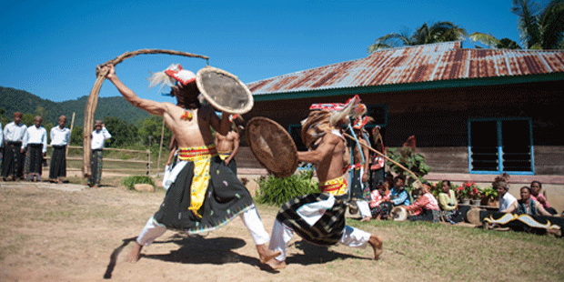
Various local community groups in different parts of the regency work to promote the local tourist industry through, for example, the development of local dance troupes and foods from local areas. In Liang Ndara village, which has been designated as a tourist site, there are programs to teach English in the local community to support the tourist industry,
Mount Mbeliling (Indonesian: Gunung Mbeliling), one of the highest peaks in the regency (1,325 meters) is a well-known destination for climbers and tourists to the regency. The area around Mt Mbeliling, which is rich in bird life, attracts bird-watching groups
Sano Nggoang
Sano (means Mount) Nggoang is 513 hectares (1.9 sq. mi.) of volcanic crater lake with depth of around 600 meters (1968.5 ft.), the deepest lake of its kind in the world.
Shark and manta ray sanctuary
In late August 2013, the local authority designated that all regency's marine and coastal water up to 12 nautical miles offshore occupied 7,000 square kilometer area as a shark and manta ray sanctuary (includes sea around Komodo Island).