
Population 146 (in 2011) Civil parish West Knoyle Dialling code 01747 Post town Warminster | OS grid reference ST858325 Unitary authority | |
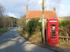 | ||
West Knoyle is a small village and civil parish in southwest Wiltshire, England, close to the southern edge of Salisbury Plain. The village is about 2.5 miles (4.0 km) east of Mere and 8 miles (13 km) south of Warminster. The A303 trunk road passes about 0.75 miles (1.21 km) north of the village. The parish was formerly named Knoyle Hodierne, after Hodierna of St Albans, wet nurse of Richard I of England, who had an estate at Chippenham.
Map of West Knoyle, Warminster, UK
The Anglican Church of St Mary the Virgin is Grade II* listed. It has 13th-century origins and was restored in 1876-78.
The Monarch's Way long-distance footpath passes through the village. Hang Wood, to the southeast, is a biological Site of Special Scientific Interest.
References
West Knoyle Wikipedia(Text) CC BY-SA