
Area 3,714 km² Local time Saturday 4:41 AM | Website Official website Literacy 53% | |
 | ||
Weather 22°C, Wind SE at 5 km/h, 97% Humidity Points of interest Garo Hills, Pelga Falls, Tura Peak Colleges and Universities Don Bosco College, Tura Govt College, Kazi and Zaman College, The ICFAI University - Meghalaya, Durama College | ||
Tura hilly town and a municipality in west garo hills district in the indian state of meghalaya
West Garo Hills is an administrative district in Garo Hills of the state of Meghalaya in India. Tura town is the administrative headquarters of the district. The district occupies an area of 3714 km² and has a population of 515,813 (as of 2001). As of 2011 it is the second most populous district of Meghalaya (out of 7), after East Khasi Hills.
Contents
- Tura hilly town and a municipality in west garo hills district in the indian state of meghalaya
- Map of West Garo Hills Meghalaya
- History
- Economy
- Administrative divisions
- Demographics
- Languages
- Places of Interest
- Flora and fauna
- References
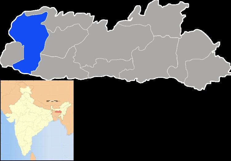
Map of West Garo Hills, Meghalaya
West Garo Hills district is located at the westernmost part of Meghalaya. The district is bounded by East Garo Hills district on the east, by South Garo Hills district on the south-east, Goalpara district of Assam state on the north and north-west and Bangladesh on the south.
History
In 22 October 1976 the erstwhile Garo Hills district was bifurcated into two districts: West Garo Hills district and East Garo Hills district The ersthwile West Garo Hills district was further divided into two districts: the present day West Garo Hills district and South Garo Hills district in June, 1992.
Economy
In 2006 the Ministry of Panchayati Raj named West Garo Hills one of the country's 250 most backward districts (out of a total of 640). It is one of the three districts in Meghalaya currently receiving funds from the Backward Regions Grant Fund Programme (BRGF).
Administrative divisions
West Garo Hills district is divided into six blocks, after the creation of South West Garo Hills district :
Demographics
According to the 2011 census West Garo Hills district has a population of 642,923, roughly equal to the nation of Montenegro or the US state of Vermont. This gives it a ranking of 514th in India (out of a total of 640). The district has a population density of 173 inhabitants per square kilometre (450/sq mi) . Its population growth rate over the decade 2001-2011 was 24.02%. West Garo Hills has a sex ratio of 979 females for every 1000 males, and a literacy rate of 68.38%.
Tura has a mixed population of Garos or Achiks (as they prefer to call themselves), Bengalis, Nepalis, Assamese, members of other ethnic groups such as the Hajong, Rabhas and Koches, Bodo and a fair sprinkling of South Indians in the Catholic Church, the teaching profession and the paramilitary forces.
Languages
Languages in West Garo include A'Tong, a Tibeto-Burman language spoken by 10,000 people in Bangladesh and India.
Places of Interest
Some places of interest in Garo Hills are Siju Cave, Nokrek Peak, Siju Bird Sanctuary, Imilsang Dare falls, Sosibibra and Rongdong falls.
Some places worth visiting in West Garo Hills are 1. Bhaitbari / Wadagokgre Excavation Site, 2. Pelga Waterfalls, 3. Tura Peak Range, 4. Nokrek Peak, 5. Nokpante Institution, 6. Typical Garo Villages and many others.
Flora and fauna
In 1986 West Garo Hills district, along with its sister districts South and East Garo Hills, became home to Nokrek National Park. The park has an area of 47 km2 (18.1 sq mi).