West Footscray is an inner-western suburb of Melbourne, Victoria, Australia, 7 km from Melbourne's Central Business District. Its local government area is the City of Maribyrnong. At the 2011 census, West Footscray had a population of 10,222.
West Footscray Post Office opened on 15 April 1914.
The most common ancestries in West Footscray were English 16.2%, Australian 15.9%, Vietnamese 7.8%, Irish 6.7% and Scottish 5.2%.
In West Footscray, 53.4% of people were born in Australia. The most common countries of birth were Vietnam 8.0%, India 5.9%, Italy 1.9%, China (excludes SARs and Taiwan) 1.8% and England 1.7%.
51.7% of people only spoke English at home. Other languages spoken at home included Vietnamese 10.4%, Italian 3.2%, Greek 2.0%, Cantonese 1.8% and Telugu 1.6%.
The most common responses for religion in West Footscray were Catholic 25.0%, No Religion 24.3%, Buddhism 8.4%, Anglican 6.1% and Islam 5.6%.
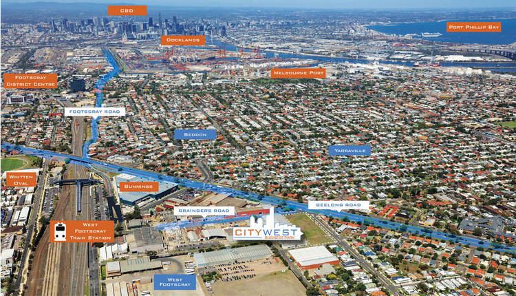
The Western General Hospital's grounds are located in Footscray although in an area many local residents consider to be West Footscray (Formerly Western General Hospital, Footscray Hospital).The Hospital's Emergency and Triage entrances are located in Eleanor Street, Footscray.The Western Private Hospital is located adjacent to the Western Hospital, on the corner of Eleanor and Marion Streets.A large number of other private medical practices are also located on Eleanor Street and Stanlake Street.There is a Veterinary Practice located on Barkly Street.The Whitten Oval in West Footscray is the home training ground of the AFL team Western Bulldogs, and was their home ground before they moved to Etihad Stadium.Barkly Village is a section of Barkly Street in West Footscray that hosts many local and ethnic grocers, stores and shops. The area has a long history of multiculturalism and includes many stores owned and operated by Indian, Vietnamese, Chinese, Anglo, Thai and Italian Australians. There is a particularly large Indian grocery store,"Bharat Traders", located here as well as independent supermarket Sims, at the end of the "Barkly Village" section of the street. Also along this strip is the Melbourne Chinese Bible Church.Construction of the new West Footscray Community Centre has been completed. It incorporates a local library, replacing the former West Footscray Library on the same site. The site is a part of the "Barkly Village" strip.The suburb has its own #wefo hashtag on TwitterThe Footscray YMCA is located on Barret Reserve, Essex Street. 10th Footscray Scout, open to all youth aged 6–26, share the reserve with the YMCA meeting in a their hall on Graham St.The 2nd Footscray Scout Group is located at Gaudion Reserve, Barkly Street. The group has a website and is open to youth aged 7 to 26 years. It is part of Kariwara District.Shorten Reserve on Essex Street is the home of the West Footscray Roosters, a local Australian Rules Football team.Johnson Reserve on Essex Street is home to a local Soccer team, and League games are regularly played on Sunday afternoons. The North Footscray Devils are also located there and North Footscray and West Footscray are usually locked in battle.The Women's Circus is based in West Footscray in the Drill Hall.There are three kindergartens:
Kingsville Kindergarten (Located in the southern part of the suburb, but in an area many residents consider to be part of Kingsville or Yarraville).Scots' Kindergarten.West Footscray Neighbourhood House.There are two primary schools in the West Footscray area:
Footscray West Primary School.St John's Primary School (Technically in Footscray, but in an area many residents consider to be West Footscray, also a Catholic school).There is also a Catholic School located in the area:
Corpus Christi Catholic School. (Again, located in the southern "Kingsville" part of the suburb).The Western Scout centre is a training centre for the adult volunteers of Scouts Australia and one of six such sites in Melbourne. Their office in the new complex at 77 Ashley Street includes equipment donated by the Footscray Rotary Club.
The following bus routes that pass through West Footscray;
216 Caroline Springs – Brighton Beach via Deer Park West, Sunshine, Footscray, Melbourne, St Kilda Road, Prahran (every day). Operated by Transdev Melbourne.219 Sunshine Park – Gardenvale via Sunshine, Footscray, Melbourne, St Kilda Road, Prahran (every day). Operated by Transdev Melbourne.220 Sunshine – Gardenvale via Footscray, Melbourne, St Kilda Road, Prahran (every day). Operated by Transdev Melbourne.411 Footscray – Laverton via Geelong Road, Altona Gate SC, Altona, Altona Meadows (every day). Operated by CDC Melbourne.412 Footscray – Laverton via Geelong Road, Altona Gate SC, Altona, Altona Meadows (every day). Operated by CDC Melbourne.414 Footscray – Aircraft via Geelong Road, Laverton North (Monday to Saturday). Operated by CDC Melbourne.West Footscray also has its own railway station.
The suburb has two Australian Rules football team competing in the Western Region Football League, the West Footscray and North Footscray football clubs.
The Footscray United Soccer Club plays at Hansen Reserve.